Total Pageviews

Sunday, June 24, 2012

Rock Hounding, or where you can go beyond Prospecting


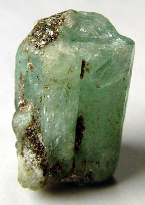
Uncut emerald one of the many members of the family of beryl minerals
Photo by Ryan Salisbury


Rock hounding is many faceted hobbies that make use of various earth materials as its objective.  Rock hounds can range in expertise from the rank amateur that collects pretty pebbles to world class experts on gemstones and minerals.  One of the branches of rock hounding is 
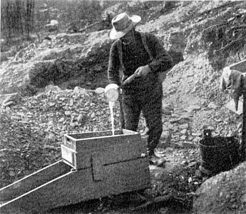
prospecting for gold and other precious metals.  There are many other fields of study that open to the rock hound as his level of knowledge increases.  Many rock hounds discover that over time rock hounding becomes a full time job.

One of the first things that have to be considered is the number of actual minerals there are, and of the latest count there were over 2000. Another thing that deserves a great deal of study is the number of minerals contained in each of the primary rack systems igneous, metamorphic and sedimentary. Each of these rocks systems contain some very specific minerals that are only found in one system. That being said has to be recognized that many mineral bridge more than one system. Probably one of the most outstanding examples of this is the occurrence of zircon they can be found in all three rock types.

Rhodocrosite from Argentina
Photo by Alberto Salguero


No doubt the most important thing most rockhounds want to learn is the identity of the different minerals they have found. This can be quite difficult considering the number of minerals that are recognized, but if you gold belt this systematically it becomes much simpler. All minerals have specific characteristics that are readily recognized that can take several forms. Many of these ways of recognizing minerals and trace their origin back to ancient times. The ancient Egyptians were quite adept at this practice and their knowledge of chemistry and mineral recognition was quite advanced.

There are a number of different ways of identifying a specific mineral among them are: hardness, color, specific gravity, transparency and fracture. One of the most accurate ways of identifying all minerals is by a process called x-ray diffraction spectrometry or what is commonly called a powder camera that is used by professional mineralogists. A powder camera admittedly is beyond the realm of rock hounds, but there are several tools that are still available to them.

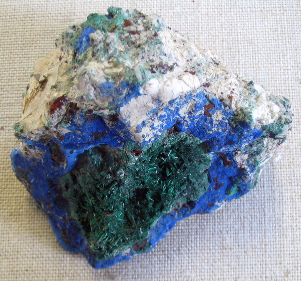
Azurite the blue mineral with malachite the green mineral from Russia
Photo by Aramgutang

The most common of these tools are the hardness testing kit that you can build yourself that are based on being able to scratch a sample. The hardness testing kit is based upon Moh’s Scale of Hardness that ranges from 1 to 10 with talc being the softest and diamond the hardest. Although you can purchase hardness testing kits you can easily make your own from readily available minerals. You can Google Moh's Hardness Scale on the Internet that will give you a list of the different minerals by hardness that are in the scale.

The next most important thing to consider is the mineral's specific gravity. The law of specific gravity was discovered by Archimedes in the city of Syracuse, Sicily during the days of the Romans. Each mineral is first weighed in the air and then weighed in water the difference between the two numbers is the specific gravity of the mineral. Once again a complete explanation of this can be found by Googling the phrase specific gravity.

Color and transparency are self-explanatory and most books on mineral identification are set up to show minerals by their color and chemical composition. Fracture is yet another important tool used in mineral identification.

Saturday, June 23, 2012

Tales of the Devil: Was it really a Gold Mine?


This is the end of the tunnel and with all the quartz veins exposed it sure makes you a believer, but subsequent tests failed to show any concentration of gold that exceeded the normal background level of gold.
Photo by Landowner


The question really arises is this thing actually a mine? The history of the area suggests that it may be something else; a tunnel excavated for the purpose of aging cheddar cheese. During the early 19th century the cheddar cheese production in the United States was in Goshen, Connecticut and spread out over several other towns in Western Connecticut. The most popular cheese that was produced was made in the shape of a pineapple that at the time was called pineapple cheese. This cheese whether it was made to look like a pineapple or simply cheddar cheese wheels. This cheese was so popular that it enjoyed a worldwide distribution being exported to the Caribbean, Europe and the Far East notably China.

The shaft and tunnel were recently rediscovered revealing a mine shaft that was about 40 feet deep with a tunnel going off from the bottom of the shaft that was 6 feet wide, 7 feet high and 10 feet deep. At the time of its discovery we all thought it was probably an abandoned mine but subsequent work that was performed on the mine with an x-ray fluorescence spectrometer (XRF) reveals no apparent minerals associated with gold or gold in this shaft and tunnel. So this left the question of what were they mining?

John Carter brought up the possibility that this was actually used for aging cheese. This hypothesis brought up one major objection from the landowner, and so far the other investigators are not aware of this possibility that what we thought was a mine was actually an underground tunnel used for aging cheddar cheese.

The major objection was the simple fact that this alleged mine was making quite a bit of water into the tunnel as well as part of the shaft. At first this seemed like a valid objection but further research reveals that they had hoses capable of carrying water clear back to 400 BC. Depending on the age of this feature it could have used hose made from leather that was secured by copper rivets, or a type of hose made from knitted linen fibers that were invented in the early 1800s. Either of these hoses was capable of being used as a siphon that would've kept the water in the tunnel under control.

In the early 1800s cheddar cheese was covered by a thin layer of cotton cloth then covered with lard causing the cheese to become waterproof. At the same time this covering of cotton cloth and lard allowed the gases that were being generated as the cheese aged to escape through the covering that kept the water from coming back into the cheese as it aged. However the cheese still had to be aged in a cool dry place which this was far from; it made water that was capable of filling the shaft about three quarters full. Without continually pumping the shaft and tunnel this complex was useless.

There was another kind of pump that have been used since ancient times called the Archimedes screw it used a helical screw turning inside a tight fitting to that was capable of raising water up to 10 m or close to 40 feet the depth of the shaft. It is possible they used a device like this for keeping the water out of the tunnel and shaft.

Had the complex been able to be used for aging cheese there would have been a series of shelves for storing the cheese, but once again these were missing so it has to be assumed that the whole complex was abandoned once the diggers were convinced it was useless for aging cheese.  The fact that further work was intended is attested to by a series of drill holes inside the tunnel.  Ultimately the vast amount of water entering the complex caused its abandonment.  This waterflow has been estimated to exceed twenty gallons per minute.  It would have been a pretty good well, but no place to store cheese.

Monday, June 18, 2012

Gold Occurrences in Botswana


Mining in Botswana


Although gold is mined in Botswana since the early 1990s diamond production has led the pack with most of the diamonds produced were of gem quality.  This made the country the world’s leading producer of diamonds by dollar value.  Other minerals produced included gold, copper-nickel matte and soda ash.  During 2005, mining accounted for about 38% of the country’s Gross Domestic Product (GDP) with more then 50% of the government’s revenue coming from the mining industry.

Almost two thirds of Southern Africa including Botswana is composed of rocks of the Karoo Supergroup and most of the rest of Southern Africa.  The rocks are deposited in a series of basins in which the deposits had their origin in the formation and breakup of Pangea. The strata in the main crew consists mainly of shales and sandstones that record an almost continuous sequence of marine deposits ranging from glacial to terrestrial the presentation from the late Carboniferous through the early Jurassic for a period of about 100 million years.

The sediments accumulated in a retroarcforeland basin, these sediments are called the named Main Karoo with a thickness of about 12,000 km. They are overlain by basaltic lavas of the Drakensberg group. The basin was formed by the subduction and orogenesis that occurred along the boundary of Gondwana and the Panthalassan Sea, paleo – Pacific. The basalt layers are approximately 1.4 km thick.

A subsidiary of Gallery Gold called Mupane Gold operated the Mupane gold mine that was located about 30 km south of Francistown. This gold came from the Tau pit, and after mid-year production came from the oxide zone of the Tholo pit. Gallery gold continued exploring other gold prospect in the area of the Mupane mine including several other prospects.

One company suspects there are outlaying members of the Witwatersrand underlying parts of the Karoo formation, but that are and there is an active drilling program that is being undertaken.

Saturday, June 16, 2012

New Life for Old Mines

This is a way that dhows how to get new life from old mines using modern mining technology,  These technology methods are now being adapted in the mining world.


Wednesday, June 13, 2012

Kitchen Utensils used for finding Gold


Many of these things can be used in the search for gold, but not all.
Photo by Jeppestown


About the last thing in the world you would expect to use in the hunt for placer gold are ordinary kitchen utensils. Just think about that some of the most useful tools in the hunt for Gold are nothing more complicated than a spoon, knife and fork along with several other common things that can be bought at a kitchen supply store.

One of the most useful things you can have as nothing more than a simple plastic colander. This is used to separate large stones that would normally go into your gold pan before they ever get there. The colander is used by placing it over a gold pan and filling it with stream gravel then pouring water over it causing the smaller particles to come out through the bottom into the Gold pan. You can then throw away the larger stones, but examine them first to be sure they do not contain a gold nugget.

Another useful kitchen gadget is a wide mesh sieve you can actually set up in the gold pan below the colander this serves to separate even more of gold bearing sand from the larger particles. The material that is caught by the strainer is retained for future panning to recover any larger particles of gold.

Although a gold pan or even better a set of gold pans are nice to have but they are not really necessary because the author has actually used plastic food containers to pan for gold. No we ever set a gold pan had to be round!

The spoon, knife and fork are used to dig around in places that are too small to use a regular shovel. This is especially true of places like crevices in rocks. In the same vein one of the most useful tools for the recovery of gold is a large serving spoon that is also used in small places that are also too large for shovel.

One of these plastic food containers can be used as a gold pan.
Photo by Stuart Spivack


Most of the gold panning kits that are now on the market include a snuffer bottle that is used to suck up small pieces of gold that are too small to be picked up by the fingers. You can use a turkey baster to do the same thing although it is a little large and cumbersome but actually works better is an ordinary eyedropper. Some kitchen supply stores supplying these things made from plastic as large as 5 ml, or 1 ounce.

Your homemade gold panning kits should also include a 10 X. magnifying glass and a pair of sharp pointed tweezers. This collection along with a conventional gold panning kit should serve in just about any situation that you find yourself in your hunt for placer gold. Who knows you may even find some other devices in your kitchen supply store that you may also find useful.

References:

This article is coming from personal experiences by the author over many years of panning placer gold.

If you would like to learn more about gold please click here!

How to Build a Gold Rocker Box:


A gold rocker box in use


A gold rocker box is a device that efficiently recovers gold from river sand and gravel that is capable of processing more gold per hour then a gold pan.  Its invention was during the Georgia Gold Rush that predated the California Gold Rush by several years.  During the days of the Forty-Niners the rocker box was considered more important then the gold pan.  It was also important during the Klondike Goldrush because the miners were able to use the rocker box on higher stream banks because it used far less water then the conventional gold pan.

The Gold Rocker Box was a slightly more complex way of producing gold that could easily be built in the field by the average miner from rough sawn lumber.  It also had the advantage of being usable by one man.  It was built in two parts; the upper part was a box that acted as a grizzly separating the larger stones from the lower part where the smaller sand and gravel went to be processed. 

In essence the lower part was a sluice box from four to five feet long, and about a foot wide.  This part of the box was equipped with a set of cleats along the bottom of the sluice to catch the gold particles, and let the lighter load of gravel run out the lower end of the sluice box as waste.

The upper part of the gold rocker was a shallow wooden box with a one half inch screen that acted as a grizzly to remove the larger stones from the gravel that was passed through it on the way to the sluice box.  The miner discarded the larger stones, but first examined them to be sure he was not throwing out any gold nuggets.

A piece of canvas that went from the back of the upper box that was attached to the lower box assured that the gravel was properly dispersed into the sluice box.  This device has survived the test of time as the big dredges often used a rocker box to finish off the concentrate of gold and other stream heavies.

To build a rocker you start by building the upper box first this is about eighteen inches by twelve inches in size, and about four inches deep.  Then a lower sluice box is constructed that is from four to five feet long, a foot wide, and about four inches deep.  The upper box is attached to the lower box with four one x twos that are about a foot long.  A piece of canvas is attached to the rear of the upper box, and is angled down to the lower box and attached at the point where the upper box ends.  The lower box is equipped with a series of wooden cleats that catch the gold from the gravel that is being passed through. 

There is also some kind of a one x two attached to both of the boxes so that the miner is able to rock the device back in forth sideways while he is pouring water in through the upper box.  The whole device is elevated from the ground with a set of legs about four inches high that are attached to the sides of the lower box.  These legs are joined together by a wooden frame that is attached to the bottom of the legs.

In use the upper box is filled with gravel by the miner, then he pours water by the dipper full washing the gravel down into the lower box.  As he adds the water he rocks the whole device back and forth so the gravel falling through the grizzly is spread evenly in the lower box, and is thoroughly washed.  The gold, if any, collects behind
 the wooden cleats in the bottom of the lower box to be removed after a large quantity of gravel has passed through the device.  The larger stones that stay on top of the grizzly in the upper box are discarded, but examined first so you don’t throw away any gold nuggets.

The rocker box finds many uses in prospecting as it is able to separate any heavier material from lighter.  It is used for the panning of platinum group metals as well as the heavier gemstones like diamonds and sapphires.

References:


Tuesday, June 12, 2012

Outlaw Gold


Illegal Gold Mining in Africa


Outlaw Gold is not something left over from the days of the Wild West it is an illegal method of mining gold that goes on today. It is especially prevalent in the countries of South America also this practice can be found all over the world. It is often used in financing rebellions and terrorism on a global scale.  It's not only goal these illegal miners are seeking they also hunt out diamonds and other precious commodities including trees and raising illegal cattle.

It isn’t the uncontrolled damage they do to the earth itself, but it is also the collateral damage by destroying the rain forest and polluting the earth with the chemicals they use for recovering gold.  These highly dangerous chemicals include cyanide and mercury that are released into the environment.  These chemicals are used commonly by outlaw miners, than released then they are released as contaminants.

One of the areas being badly affected is the Amazon rainforest in Brazil, Columbia, Ecuador, Guyana, Peru and Venezuela where large areas are being laid waste.  With large areas are being mined by outlaw gold miners being driven by the ever increasing price of gold as investors try to find shelters in commodities rather then the stock market.  Gold futures have recently traded for over US$1,600 for delivery in December.  Gold recently reached a record high on September 22, 2011 of US$1,923.70 per troy ounce. (31.1 grams/ounce).  Many gold experts expect gold to rise to US$2,000 per ounce by years end.

Outlaw gold mining has increased in the rain forests of the Amazon Basin and other parts of the world that have mineral riches to the extent that in many places in the world the situation has gotten out of control.  In some of the areas affected the increase of illegal mining activity has rose six fold in recent years.  Brazil it the exception to the rule since they have better law enforcement policies.  It is still a problem for Brazil, however with no easy solution.  Most of the damage is caused by drilling and blasting causing deforestation and the use of mercury by the miners that pollutes both the air and water of the affected area. 

The large mining companies are not to blame for this situation, rather it is the outlaw companies that do not apply modern mining methods and in many cases are quite primitive.  As a consultant to a mining operation in South America I am only too well aware that in just the practice of blasting many of these operators are working like it was still the 19th century where a blast is initiated with a cigar and length of fuse.  There are far better methods for this then a stogie.

How the Geological Theory of Uniformitarianism affects Everyone's Future


James Hutton the founder of the Theory of Uniformitarianism 


It was during the mid-17th century that the Archbishop JamesUssher of Ireland and a notable biblical scholar used the Bible to determine the age of the earth based on the generations described in the Bible. From carefully counting the number of generations described in the Bible Ussher it determined that the earth had been created during the year of 4004 BCE. This may not indicate the actual age of the earth although it does tell how many generations are described in the Bible.

A little more than a century later the Scottish geologist James Hutton who is called the father of geology came to the conclusion the earth was much older then it was believed to be by Archbishop Ussher. Working out of the University of Edinburgh Hutton laid down one of the basic tenets of geology when he suggested that the processes occurring today for the same processes that had acted in the past, and would be the same processes working in the future. This is a polite way of saying, “Nothing ever changed and nothing ever will.”

It was in 1785 that Hutton wrote, “we find no vestige of a beginning, no prospect of an end.” James Hutton, 1785.  100 based his theory on was the slow, natural processes that he is observed in the landscape of Scotland. One of the first things he realized was that if a stream was flowing for enough time it would create a valley. He also observed that ice could a erode rock, that sediment could accumulate in such a way as to form new landscapes. I'm also realized that the effects of great disasters on the face of the earth such as earthquakes, asteroids, volcanoes and floods are nothing more than a part of the regular cycle of earth processes.

The entire theory is postulated by Hutton known as the Theory of Uniformitarianism is based on the slow, natural processes that occur on the face of the earth cussing him to speculate that millions of years would've been required to form the surface of the earth into its present state. This theory was used to give rise to a new science that was closely related to geology that is called, “geomorphology.” This is the study of landforms and how they were created.

Hutton himself is not a very good writer that is considered by many to be unfortunate, but his paper of 1785 suggested an entirely new theory of geomorphology that is the study of landforms and their development. Another sentry was to pass before another geologist Sir Charles Lyell. Whose money and metal book the principles of geology that was published in 1830 popularized the concept laid down by Hutton in his earlier work on uniformitarianism.

Today the age of the earth is estimated to be about 4.50 5 billion years old with a planet having had enough time for the slow, continuous processes of geology to mold and shape our as we now know.  In the same vein we know that sudden disasters have also had some very profound impacts on our landscapes.

In 1994, the US National Research Concil will stated:

“It is not known whether the relocation of materials on the surface of the Earth is dominated by the slower but continuous fluxes operating all the time or by the spectacular large fluxes that operate during short-lived cataclysmic events. (Davis, 18).”

Today it is recognized that the water that falls on those writing during a storm slowly erodes the soil, wind is capable of moving the sands of the desert's, floods can change the course of a river while the theory of uniformitarianism unlocks the keys of our distant past and predicts the future and is the controlling factor for everything that occurs today.

For further reading about this subject consult:

Davis, Mike. Ecology of Fear: Los Angeles and the Imagination of Disaster.
Lyell, Charles. Principles of Geology.
Tinkler, Keith J. A Short History of Geomorphology. Barnes & Noble Books, 1985.

Tales of the Devil: Origin of the Rowe Schist

The earth movements that affected the Appalachian Mountains after the Taconic Orogeny   USGS

During the late Cambrian and early Ordovician a series of turbidite flows came down the continental slope of the North American craton.  This was the origin of the Roweschist formation.  Turbidites are also good sources of gold ore.  There are several examples of this kind of formation worldwide with the Witwatersrand of South Africa being the most notable.  Much of the gold ore from Timmins, ON is another example as are many of the deposits of the world.  To date the Witwatersrand has produced around 40% of the entire world’s gold supply in the past 40 years.  The gold mines found here are some of the deepest in the world that now are approaching 13,000 feet deep.

Earth movements associated with the Taconic Orogeny during the late Ordovician caused this layer of turbidite to be shoved to its present location close to the Iapetus Suture zone that locally in Connecticut and New York is called Cameron’s Line under differing names it reaches to the mountains of western Norway.  It is truly one of the largest suture zones on earth.  By definition a suture zone is also a subduction zone where rocks of oceanic origin are forced under the continental margin.  Cameron’s Line is about two miles west of the Rowe schist the formation that underlies the property belonging to the finder of the Whodunit Mine.

According to the USGS the following illustration graphically explains the Taconic Orogeny an Alpino type orogeny, a long narrow belt of mountains that formed the Taconic mountain range.  This is the orogeny that initiated the first of several mountain building events that occurred in the Northern Appalachians.  This is the orogeny that had the greatest effect on the Litchfield site.

The site itself is composed of a series of turbidite flows that flowed down the continental slope into a back arc basin behind the island arc.  This was composed of the sand and mud component illustrated in the first of the illustrations shown of the below diagram.  The Hoosac Schist on the landward side of Cameron’s line is represented by the portion marked sand.  The continental crust is represented by the Precambrian rock north and west of the site on the landward side of Cameron’s Line. 

Cameron’s Line is where the Hoosac schist and the portion marked sediment meet in a long suture line that extends from Staten Island, NY that was broken in half after the Atlantic Ocean opened during the Mesozoic and after passing through Ireland, Scotland eventually ends in the mountains of northern Norway.

When the Taconic Orogeny ended the mountains that rivaled the Himalayas in height were completely eroded away to a flat plain we know as a peneplain.  There were small mountain building events that occurred during the Silurian that although they affected the local area were so small as to be hardly noticed.  The next big event that affected the eastern seaboard occurred during the Devonian called the Acadian Orogeny.


The Acadian Orogeny produced a different type of mountain range that was much broader then the Taconic Orogeny that to geologists is a Hercyanian type orogeny that was caused when Europe sideswiped the North American Continent.  It was during this event that the Rowe schist was intruded with molten magma causing it to become a type of rock called granofels.  This action caused many secondary minerals to be deposited in the schist ilmenite being the most prominent.  The event also caused further deformation to the Rowe schist.

At the end of this orogeny the Rowe schist has stayed above sea level unlike at the end of the Taconic orogeny as the rocks were eroded smooth the ocean came back to cover the land with ocean water.

Land affected by the Acadian Orogeny.  The original path of Cameron's Line is depicted in red. 


For the most part the only Orogenies that affected the local area were the Taconic, the Silurian (?) and the Devonian.  The later Orogenies affected the lands to the south and east.

Thursday, June 7, 2012

Gold Occurrences in Benin


Map of Benin


Mineral resource development is controlled by the Office Béninoise des Mines (OBEMINES). Benin has been revising its mining laws in order to attract foreign investment.

Benin has gold, iron ore and phosphate potential and has awarded several exploration licenses for gold exploration in the country to foreign investors. There are deposits of brick and china clay, feldspar, the Loumbu Loumbo low grade iron ore deposits and the Mekrou phosphate deposits. The development of the Loumbu Loumbu and Mekrou deposits hinges on the proposed development of a hydro electric power scheme that is to be constructed on the Mekrou River. Gold mineralization has been identified in the Atacora and Alibori regions, where hard rock and alluvial deposits are known to exist. At Alibori, a 350 km2 prospective area includes alluvial and vein hosted gold occurrences.

Major sources of alluvial gold and diamonds can be found in the Birimian rocks that are found in Ghana, the Ivory Coast, Mali and Burkina Faso   These rocks derive their name from the Birim River thay are one of the main tributaries of the Pra River of Ghana.  The same rocks also contain the country’s most important diamond deposits.  Diamonds are produced in Ghana and Mali that are the second and third largest producers in Africa.

The gold and diamond bearing rocks are called the Birimian Terranes that are composed of a mix 0f meta-volcanics, meta-sedimentary and rocks that are plutonic in nature.  Almost half of the rocks found in the southern part of the West African Craton are alkaline granites.  These rocks formed in a period of about 50 million years between 2,200 and 2,100 Ga years ago.

It is believed the Birimian Rocks that stretch across the countries that are to the north of the Gulf of Guinea formed when a series of island arcs were driven together forming a series of parallel belts that trend to the northeast in a belt that is about 40 to 50 kilometers wide.  Many of the volcanic rocks have been metamorphosed into greenschist facies.

Although most of the gold mined in the country is recovered by artisanal miners from the Birimian Terrane it has recently discovered more gold is found in the overlaying conglomerate of the Tarkewian formation.  The gold does not have its origin in the Birimian Terrane. 

There are several varying theories about the origin of the Birimian Terrane.  One theory holds the rocks were formed by the collision of the Archean Cupixi-Carajas craton of the Southern Guiana Shield.  Another theory that is more widely accepted is the terrane has it origins in a mid-oceanic series of volcanic island arcs that formed a crust that was then thrust faulted onto the West African Craton that was later compressed into a series of folds.

During the recent civil war in Benin foreign investment literally dried up, but with the onset of peace it is beginning to flow once again.

Wednesday, June 6, 2012

Tales of the Devil: The Whodunit Mine


Typical Landscape at the Whodunit Mine
Photo by P. L. Chadwick


No this isn’t a tale of the nether regions it is the story about the discovery of a long abandoned mine in western Connecticut.  For lack of a better name we might as well call it the “Whodunit Mine.”  The mine is on private property, and its owner is in the business of raising big dogs.  He will loose the hounds on anyone who goes trespassing on his property, so let that be a warning.

The old mine was discovered by the owner when he wanted the zoning classification of his property changed from residential to farming.  There were several old pits in the ground the zoning enforcement officer wanted filled in as part of the change.  This got the curiosity of the owner that led to the discovery of several acres covered with pits and several hundred feet of trenching giving the property the appearance of a battlefield.

The site also contains timber rattlesnakes
Photo by Trisha M. Shears


Somewhere in the process last April 2012 he contacted me because I operate a school for prospectors teaching the fundamentals of prospecting that I try to tailor to the individual.  The owner already knew how to pan for gold, what he was really curious about was what he had on his property.  We made a trip to the site where we looked the site over and discovered plenty of evidence of prior mining activity with many prospecting pits and several hundred feet of trenching.  This activity covered several acres of the property.  From prior experience I know what this kind of work costs in money and labor.

In the past I had some involvement with Robert J. Altamura who worked for the Connecticut Geological and Natural History Survey when he prepared a map of the Bedrock Mines and Quarries of Connecticut.  Since I had a copy of the map and its accompanying booklet I checked and the site wasn’t on the map.  With that I contacted Margaret Thomas the state geologist and told her I’d found an unlisted mine.

Another creepy-crawler found on the property is the copperhead
Photo by Trisha M. Shears


Because the owner was a contractor he had some construction equipment including a backhoe that he used to explore the old mine.  He called me on the phone one morning in early May to tell me he had dug into what turned out to be an apparent mineshaft and had discovered many old bottles and other artifacts.  I told him to stop digging and I’d contact the state archeologist.  The state archaeologist told me he couldn’t come until May 24.

In the meantime I also contacted the Yale Peabody Museum who put me in touch with their mineral collection manager.  A bit later I contacted the geology department chairman at Hofstra University a personal friend to tell him what we had discovered.  Ultimately both the mineral manager and the chairman of the department agreed to come to the site on May 24.

What happened on the 24th was the meeting of a blue ribbon panel consisting of one archaeologist, three geologists and two engineers.  The net result of the meeting was we couldn’t determine what they had been mining.

The mine contains the following minerals: amphibolite, beryl, corundum, ilmenite, kyanite magnetite, pyrites talc and other minerals that are yet to be identified.  We also found one small speck of gold.

My own theory of this is:

The digging probably happened in the 1850’s after somebody came back from the California Gold Rush and decided there was gold on this property and went looking for it.  The debris filling the mineshaft has been dated to the post Civil War Era by the state archaeologist.  The mineshaft yielded what appears to be a cast iron ladle that could be used in assay work.

This tale is going to be continued!

Sunday, June 3, 2012

Gold Occurrences in Angola


Tazua Falls on the Rio Cuango is one of the richest diamond and gold rivers in Angola
Photo by Brian Harrington Spier


Gold and base metal potential remains in Angola, but because of the ongoing civil war in Angola much of this potential remains unexploited.  Even though the country has been wracked by this conflict mining still provides the country with some foreign exchange with about 98% of it coming from diamonds.  The rest of the countries earnings are from oil.  Before the civil war Angola was an important producer of gold and other metals.  Because of the ongoing civil war it is difficult to reach much of the country from the outside.  No doubt there are world class deposits of gold waiting to be discovered in Angola.

Geologically Angola was once part of Southern Brazil until the Atlantic Ocean commenced opening during the Triassic period 220 million years ago; today the two countries are separated by the Atlantic Ocean.

Twelve billion barrels of oil have been found in the deep waters off the coast of Angola since it was first discovered in 1955.  Officials at Sonangol, the country’s oil company say this is only a small part of the total potential.

Upper Proterozoic Fold Belts of the Pan African are found along the margins of Angola’s Precambrian shield.  Among the most important are the West Congo, Damara and the Maiombe-Macongo.  This fold belt displays the occurrence of both gold and base metals along with a wide variety of industrial minerals.

The Lower Protozoic and Archean rocks are composed of the Angloan, Maiombe, Cassai and Bangwelo shields along with the granitic, gneissic rocks sedimentary (greenstone) belts from the Angolan, Maiombe, Cassai and Bangwelo shields and the Kwanza meta-
Volcanic sedimentary (greenstone) belts are present in the south-central part of the country as the Cassinga and Menonque greenstone belts.  These rocks go on to the Cunene basic to ultra basic complex that occupies more then 20,000 sq. km in southwestern Angola.

Angola is blessed with mineral riches with most of the rivers flowing down from these areas bearing lode gold and there is plenty of areas bearing lode gold waiting to be explored.

Saturday, June 2, 2012

Gold Occurrences in Algeria


Image of Pangaea before it broke up beginning in the Triassic 220 million years ago


Gold has been found in the Atlas Mountains of Algeria since early times predating the Romans.  In southern Algeria is the 1,425 square kilometer tract of the Tirek-Amesnessa gold concession of GMA Resources Plc that owns 52% of the concession with the remainder 48% belonging to Sonatrach AVAL, the giant Algerian oil & gas giant.  The companies have recently constructed a new heap leach facility there.  They are also conducting an extensive exploration program covering the entire concession.

During the late Permian Africa collided with North America causing the southern Appalachians to be thrust skywards into mountains that were higher then the Himalayas at the time the Little Atlas Mountains of Algeria were part of this mountain mass.  This set of tectonic mountains completed the building of the supercontinent Pangaea.  They were later separated when the supercontinent broke up during the Triassic with the opening of the Atlantic Ocean.  There is a feature in the Southern Appalachians and the Little Atlas Mountains called the gold belt that in North America was the home of America’s first gold rush.

The Amessmessa located in the Little Atlas Mountains is part of this gold belt that was transported across the Atlantic Ocean by the action of tectonic plates to where it is today.  It has been estimated this deposit could generate gold at the rate of 200,000 to 300,000 ounces of gold per year.  This is going to be hard rock mining that is going to require massive amounts of mechanical equipment.

The Atlas Mountains run for approximately 1,300 miles (2,090 km) through the Maghrib countries of Morocco, Algeria and Tunisia.  The mountains extend from the Atlantic Ocean, south of the Agadir, to the Mediterranean Sea near Tunis.  The Atlas Mountain systems comprises a series of roughly parallel ranges that go east to west that include the Anti Atlas, High Atlas, Middle Atlas, Saharan Atlas, Tell Atlas and other lesser ranges.  Some people think the Rif range running along the Mediterranean coast of Morocco is also part of the same system.

There are deposits of gold, silver, lead, zinc, iron, manganese, antimony, phosphates and oil found throughout these mountains.  Some of these many deposits have been worked since ancient times, others have only come into prominence in modern times.  Gold is found in many places as both hard rock deposits and as placer gold in the Wadis washing down from the mountains into the Sahara desert.  Many of these deposits have remained unexploited to this day.