Total Pageviews

Wednesday, August 31, 2011

Gold Occurrences in the Norumbega Fault System of the Northeast Coast of North America

Nubble Light on Cape Neddick in York Maine.  The light is on the Norumbega Fault as evidenced by the intrusions of gabbro that were emplaced during the late Cretaceous, and the earlier intrusions of grano-diorite.  The light itself and the near shore are one of these intrusions found in the Kittery formation of southern Maine.
Photo by Michael Murphy


Like its better known cousin on the west coast the San Andreas Fault the Norumbega Fault System ranges along the coast from New Hampshire through Maine to the eastern coast of New Brunswick in Canada.  This is a fault system that has been little known until recent decades although it has displayed a history of gold deposits since the late 1800s.  Across the border in New Brunswick there has been a great deal of exploration recently with several extensive deposits of gold and other metals having been found.  It has only been in recent years that it has started receiving the attention that has been accorded its southern relative the Brevard Zone, but the latter has been the scene of gold mining in the early 19th century with some of the mines remaining open until the advent of World War II.  A recent drilling program undertaken at one of these old mines in South Carolina has discovered proven reserves exceeding 3,000,000 ounces/ton of gold.

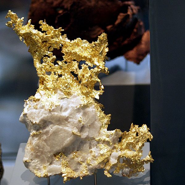
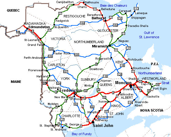
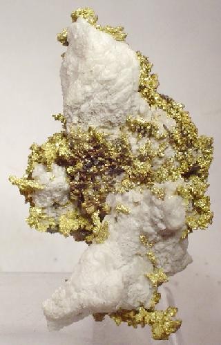
As part of a project undertaken by the Geological Survey of Canada (GSC) in southwestern New Brunswick that is one of the most important gold occurrences in the Province as of 1999.  Because of ground cover and lack of outcrops little is known of the geology of this district except it is hosted in volcanic and subvolcanic rocks that occur on Poplar Mountain.  The gold in this deposit is accompanied with arsenopyrite.

A quartz vein in grano-diorite.
Photo by Walter Siegmond


This fault is the second largest fault system in the northern Appalachians exceeded by the Ordovician Fault System that under various names goes from Staten Island New York to Newfoundland where it enters the sea at Baie Verte NF.  When the continents broke apart during the Jurassic the same fault continues through the British Isles and into the mountains of western Norway.  Both of them mark the suture zones between land masses that were moved by tectonic forces.

Gold deposits and other metals have been discovered along both suture zones.  The most active place at the present time is in New Brunswick.  Another hotspot is in Wales in the British Isles.  Little exploration has occurred for decades because of the difficulty in using ordinary exploration methods on this terrain due to heavy groundcover.

One of the best places to look for mineralization is where two faults join at right angles like the Lake Char and Honey Hill faults do in Connecticut.  Both of these faults are a southern extension of the Norumbega Fault System.  Another area of interest is where the City of Worchester MA is located.  If you don’t think there is any gold in the Norumbega Fault System we recently found a deposit that assayed 5.9 on/ton gold and 1.1 oz/ton Platinum.  I am not disclosing its location, so you can go and find your own.

Tuesday, August 30, 2011

The National Instrument 43-101 (the NI 43-101 or the NI


This is a mineral resource scheme that is used in Canada for the public disclosure of information about mineral properties in Canada or by extension all over the world if securities in the companies promoting such properties are sold to the Canadian Public.  In practice the NI 43-101 is a strict guideline about how companies whose stock is traded in Canada can disclose both scientific and technical information about mineral projects on bourses under the supervision of the Canadian Securities Administrators.  The list includes the Toronto Stock Exchange (TSX) or the TSX Venture Exchange (TSX-V).  Many of these companies are listed on other stock exchanges outside Canada, such as the Johannesburg Stock Exchange, Australian Securities, the London Stock Exchange and all the exchanges headquartered in New York City.

There are many different types of reports that are covered including press releases, reports, the reporting of resources and reserves, presentations, oral comments and websites.  Included in the classes of minerals covered are metalliferous deposits, precious metals, coal, bulk minerals, dimension stone, precious stones and mineral sands (placer deposits).  For TSX listing purposes the NI 43-101 Technical Report would have to be accompanied by a report that is prepared in accordance with NI 43-101 specifications.

The NI 43-101 grew out of one of the biggest mining scams in history, the Bre-X (Busang) scandal to protect investors from mineral project disclosures that weren’t substantiated.  The Bre-X scandal occurred when it was claimed there were over 200,000,000 ounces of gold in the deposit or 8% of the total world’s supply.  It was all smoke and mirrors and a huge fraud.  Its chief geologist committed suicide by jumping from a helicopter over the mine-site.  The whole thing was a massive fraud with no gold.  The core samples had been salted with gold, and after analysis in an independent lab many of them proved to be scrapings from jewelry.  The investors lost their shirts!

Bluntly, the purpose of the NI 43-101 is to protect investors from misleading, erroneous or fraudulent information or claims relating to mineral properties is not published or promoted to investors on stock exchanges that are overseen by the Canadian Securities Authority.  This includes stock issued by foreign corporations selling securities in Canada.  

The NI 43-101 stipulates and codifies the form and content of a compliant report (i.e.; a report that complies with the Reporting Standard).
Prescribed disclosure within the National Instrument relates to;
§                    All disclosure of scientific or technical data, including disclosure of a mineral resource or mineral reserve, concerning a mineral project on a property material to the issuer must be based upon information prepared by or under the supervision of a qualified person

§                    What the National Instrument is to be used for, such as which types of mineral properties must be covered by a compliant report
§                    Prescribes the terminology to be used to describe various features, both geologically and financially, within the report
§                    Stipulates the type of information to be discussed and the technical data which must be portrayed, for various levels of reporting
§                    Prescribes a list of approved Competent Persons, and the definition of Groups and Associations which may qualify to certify such a person as "Qualified"
§                    Prescribes that a Qualified Person vouches for the accuracy and completeness of the contained information and the manner in which it is presented
§                    Provides guidance on reporting Historical mineral resource estimates
Proscribed disclosure within the National Instrument precludes a company from reporting;
§                    quantity, grade, or metal or mineral content of a deposit that has not been categorized as an inferred mineral resource, an indicated mineral resource, a measured mineral resource, a probable mineral reserve or a proven mineral reserve
§                    results of an economic analysis that includes inferred mineral resources
§                                allows for the potential grade, quantity and metal or mineral content of an exploration property, provided that a qualifying statement is made as to this being conceptual in nature
§                    the term preliminary feasibility study, pre-feasibility study or feasibility study when referring to a study unless the study satisfies the criteria set out in the National Instrument

Friday, August 26, 2011

Orogenic Gold Deposits


A typical specimen of orogenic gold from California
Photo by Raimond Spekking


Over the last century this class of gold deposit has been known by many different names like mesothermal gold deposits, metamorphic gold, gold-only, lode gold, shear-zone hosted, structurally controlled and a host of other names including greenstone-hosted and turbidite hosted deposits.  To cover this mélange of varying names the term “Orogenic Gold” has been proposed by (Grove et al) in 1998 to cover all these varying terms.  The reason for the change is to lower the confusion in terms since over the years they have changed causing a great deal of confusion in the scientific community,  The reason for this confusion is because of the nature of these gold deposits.  Many of these deposits are hosted in rocks that are intensely deformed and have been intruded from the effects of  regional metamorphism or intrusion by magma.

The Highlands of New York and Southern New England.  This is the type of terrane where gold might be expected.
Camerons Line runs through Connecticut to Staten Island NY.  The black on the map represents an ancient suture zone where rocks of continental origin are in contact with sedimentary rocks that were metamorshosed to schist during the Taconic Orogeny.   USGS
One of the important features of describing these gold deposits as orogenic gold deposits is because they can be found in any type of rock.  Deposits of this nature can be found in metamorphic terranes of various ages that display variable degrees of deformation.  The rocks that host gold deposits range from volcano-plutonic or clastic-greenschist facies commonly found in amphibolite or granulite.  Deposits of this nature can be found in areas that have undergone regional metamorphism or where the immediate area has undergone local contact metamorphism from the intrusion of hot magma.  Some of these deposits can be found in areas that at present represent areas of ancient major tectonic boundaries.  An example of this is found in the north-east part of North America in the fault contact between continental rocks and deep sea rocks that is represented by a fault system undergoing several name changes, but locally is called “Cameron’s Line.”  Most of these features are either compressional or transpressional tectonic settings.

You can find orogenic gold deposits in metamorphic terranes that display various degrees of deformation and various ages.  The rock hosts are various environments that include volcano-plutonic and sedimentary-clastic terranes.  The host rocks have usually been metamorphosed to greenschist facies.  In some places locally the metamorphism can be amphibolite or granulite.  Typically the gold deposits of this environment occur in regional crust scale environments.  They usually display a brittle to ductile style of deformation.  In many cases they are likely the present day expression of major ancient tectonic boundaries.  The gold deposits can be found in  any host rock.

These is a wide diversity of environments displayed that have strong structural controls in the gold deposits.  Orebodies are found in all sizes and all scales.  The morphology of these deposits is very variable including such diverse types as (1) brittle faults to ductile shear zones, (2) extensional fractures, stockworks and breccias and (3) fold hinges.  Many of these Orebodies are composed of highly altered host rocks that have disseminated mineralization of fissure filled deposits.  Many of these deposits can display a large vertical size exceeding 1 km in extent or more. 

Wednesday, August 24, 2011

Gold Occurrences in New Zealand


Map of New Zealand


There are several different types of gold deposit that are found in western New Zealand.  Orogenic gold deposits are found in both fault and shear zones at all crustal levels in quartz veins found within and around brittle ductile transition zones. 

The framework of New Zealand is controlled by two major faults the Wellington fault in North Island that terminates at the Bay of Plenty to the south coast, and the Alpine Fault that traverses South Island. New Zealand was rifted from Australia millions of year ago.  There is a subduction zone to the east that today drives the volcanoes found on the west side of North Island.  It is these volcanoes and earlier volcanism that has formed the gold deposits of the Islands.

Together these two faults represent a suture zone that runs the length of the islands.  It is a well known fact that many metal deposits are found associated with suture zones, and that is true in New Zealand.  Another mineral that is often found in suture zones is nephrite that is commonly called jade.  Jade is found in areas of high pressure-low temperature metamorphism commonly in blue schist grade rocks.

These deposits originated ranging from 3 km to 12 km deep with hot water from 200o to 400o C.  The gold deposits were brought to the surface by earth movements and erosion. The gold deposits are found mostly in regionally metamorphosed Paleozoic sediments that are found including those found at Golden Blocks in the northwest at Nelson, Reefton and Lyell.  Other deposits are found at Preservation Inlet in Fiordland where gold bearing quartz veins are found dipping steeply and are generally striking parallel to the axes of folding in greywacke and argillite slate host rocks.  Most of these veins are found to de discordant to the bedding. 

The lodes in these locations are usually less then a meter wide and 200 meters long.  The Birthday Reef at Blackwater, Reefton is the largest quartz vein found in the Paleozoic rocks.  This vein averages about 60 cm wide and has been mined for a distance of 1070 m that extend to a depth of 830 m.  There is also disseminated gold deposits that are next to the quartz lodes at Globe-Progress as well as others at the Reefton deposits.

There are also deposits of gold found in the Mesozoic rocks in the schist of the Otego and Marlborough as well as the greywacke found in the Southern Alps.  Here the lodes are typically lensoidal in shape that are rarely more then a meter wide and are localized along single or multiple shear zones that are parallel that usually dip steeply and are discordant to the bedding of the country rocks.  One exception is a lode vein found at McRaes where the deposits are found in the Hyde McRaes shear zone.  These gold bearing veins have a strike of more 25 km.

Many of the gold deposits are found in saddle reef deposits similar to those found in eastern Australia where they occur as veins of quartz that approach near horizontal deposits of quartz found parallel to the bedding planes in turbidites ranging in age from Silurian to Devonian in age.  A good example of this kind of deposit can be found at the Hill End Gold Field in New South Wales.  This deposit was developed in regional metamorphism over a considerable length of time.

Gold deposits can be found the length of New Zealand, but are mostly found on the western side of the islands.

Gold Occurrences in Ontario


Kidd Creek Mine in Timmins Ontario   P199


The City of Timmins lies about 600 miles north of New York City it is common knowledge to most Americans that the Gold Rush happened in California in 1849, but a far larger gold rush occurred in Porcupine Ontario fifty years later.  Porcupine was later incorporated into the Township of Timmins, but Porcupine still exists complete with a Tim Horton’s shop.  One of the mines, the Dome Mine is still producing gold over a century later from a vast open-pit mine.  The other mines are now closed, but in West Timmins they have recently discovered one of the largest gold deposits of the past century.  It appears they haven’t written the last chapter in the book about Timmins Gold.

Most of the gold found in Ontario is found in the so-called Greenstone Belts the largest of which is the Abitibi reaching all the way from Wawa on Lake Superior into Quebec past Val D’or.  From this one Greenstone Belt there are more then 160,000,000 ounces of gold that have been mined since its discovery in 1909.  This is only one of several Greenstone Belts in the province that has produced gold. 

Gold bearing belts are found in several other localities in Northern Ontario with other notable occurrences at Cochrane, Red Lake, Hemlo, Marathon and so many other places that prospecting for gold in Ontario is practically the same thing as carrying coals to Newcastle. Many of the VMS mines in Ontario produce gold as a byproduct.  One example of this kind of deposit is found in the Kidd Creek Mine to the east of Timmins that was the site of a famous discovery in 1963.  Most of the gold that has been found in Ontario is from hard-rock deposits.

Somebody has said that there has never been a single nugget of placer gold that has been found in the province.  According to an open file report by the Ontario Geological Survey there appears to be a considerable amount of float gold present in the glacial drift of Ontario.  It is probable that placer deposits have not had enough time to develop since the glacier melted.  At any rate the report covers about two hundred pages listing all kinds of places where placer gold and indicator minerals for kimberlites have been found in Ontario.  You can access this document online by going here.

According to the author’s prospecting friends in Ontario all the prospecting done in the province is in hard rock. With the amount of gold that has been discovered that really makes sense. It could be possible that what has worked in the past will work in the future. The possibility of placer mining has not happened because of the scarcity of alluvial gold. Although the Abitibi region of Ontario holds many lode mines, placer deposits are practically non-existent. The glaciers of the past million years took the gold laden soil south and deposited it in states across the American mid-west. These are from New York to Illinois.
Most of the gold of Ontario is found associated with the greenstone belts of the Abitibi and Superior Provinces that span the whole province from Manitoba to Quebec. It is thought that the gold was mobilized from the greenstones that are metamorphosed basalts by hot water. It was deposited in quartz veins that are often found near fault systems.
Another place that gold is found in Ontario is in beds of ancient conglomerate. An example of this type is a large piece of conglomerate on display on the lawn of the library in Timmins. This is probably an ancient placer deposit that has been fossilized. The stones in this piece show little or no sign of having been metamorphosed. It is an example of an Archean sedimentary rock.
Some of the other regions of Ontario that have produced gold is the area around Wawa and Marathon. The Western part of the province is also promising country to prospect. Prospecting in Ontario is not just limited to looking for gold. There is at least one active diamond mine in the James Bay Lowlands, as well as diamond bearing kimberlites found in several places in the province.
Diamonds are often found in the same rivers and streams that carry gold in their sand and gravel deposits. The largest diamond that was ever found in North America was found in a placer deposit.
There are plenty of other minerals that can be found in Ontario as well. These minerals might not be as glamorous as searching for gold, but in many ways they are more important in the modern world. Among them are copper, lead, zinc, nickel, iron, lithium, beryllium, niobium, tantalum and the rare earth elements. The platinum group metals are often found associated with copper, cobalt and nickel.
If there is anyplace where people have looked in Ontario for mineral wealth they have found it. The province maintains a very active geological survey that holds vast amounts of knowledge concerning the mineral wealth of Ontario.

Thursday, August 18, 2011

The Government’s Chicanery with Gold


A gold bar!   www.realterm.de


With the price of gold reaching close to the $1,800 mark for a troy ounce many governments are looking at this high price as another way to grind their gold mining and owning citizens down more in their eternal lust for other people’s money.  The scam works like this by government decree the only place where you can sell gold is to the government at a steeply discounted price.  The next decree aims directly at the gold owner that states all gold must be sold to the government at their price that is far below its market value.  The alternative to these schemes is where the government out-and-out seizes all the gold from its citizens.

So far this ploy hasn’t reached the larger countries, but it might not be a good idea to hold your breath before it does.  Politicians in their eternal lust for new sources of funding know no bounds when it comes to your money.  What makes it even worse is when they paint a picture of making their confiscatory policies to be in the common good.  Well, the road to perdition is paved with good intentions.  One of these good intentions is grabbing your gold.

In the State of California they recently closed the state to dredging for the next five years on some sort of trumped up charge that the closure was for the common good of the environment.  They conveniently forgot there are people whose only source of income is from the gold they win from the streams in the state.

The seizing of gold isn’t beyond the pall of the US Government since they have already used this once in 1933 during the Great Depression.  The did raise the price of gold to $35 per troy ounce, but they left it there for more then forty years finally allowing the price to float to market levels in 1974.  They also completely disallowed gold mining during World War II, once again in the name of the common-good.  Many of the mines that were closed then have never reopened.

No doubt there is going to be a lot of gold that is apt to return to the earth from whence it came so the government can’t get their hands on it.  What’s next silver?  

Wednesday, August 17, 2011

Gold Occurrences in Quebec


Topographic Map of Quebec   NASA


There are many gold deposits in Quebec many of which are being explored or developed into active gold mines at this moment.  The province is also the eastern terminus of the Abitibi Gold Belt that begins in Wawa Ontario and supposedly ends at Val D’or Quebec.  This is the second largest gold belt on earth only the Witwatersrand of South Africa is larger.  Since it was first discovered in the early 1900s the Abitibi has produced more then 160 million troy ounces of gold, more then there is in Fort Knox.

There are several different parts of the province that contain gold either as native gold or associated with other metals of which copper is one.  This is the case in the copper/gold mines around Chibougmau.  There is a goldmine located about 60 km west of Chibougmau on Rt 113 in the Chapais Mining Camp. Further north these is mining exploration work being undertaken on the Taigus Road that goes from Radisson east to within a little more then 100 km from the Labrador border.  There is also further exploration work being done in the far north of Quebec in the Ungava Bay Territory.  

The Matagami Camp is another hotspot of activity for both gold mining and exploration with several mining and exploration examining the surrounding area for gold and other base metals.  Exploration has reached the level where a surface mine is being opened near the town of Malartic between Val D’or and Rouyn-Noranda.  This site is located in the Abitibi Gold Belt.  A new find of Volcanogenic Massive Sulfides has been reported near Rouyn-Noranda. 

A great deal of exploration and mining activity is found north of the St. Lawrence River especially in Archean aged rocks, but most of the placer activity is found south of the river especially in the rivers and streams that drain the Height of the Land on the Maine Border.  Gold is found in the area centered on Sherbrooke and Thetford Mines as well as along the Chaudiere River.  This is an interesting area because it also displays the same kind of chaotic geology as the rest of the area that is on the seaward side of the Brampton/Baie Verte fault where continental terrane and oceanic terrane collided during the Taconic Orogeny forming the Iapetus Suture Zone.  This entire area in the Eastern Townships warrants further exploration for lode gold.  

Tuesday, August 16, 2011

Gold Occurrences in New Brunswick


Road Map of New Brunswick


Because New Brunswick shares an extremely complex geological past with the New England States further south combined with government policy to develop their mineral resources the province has many mines in both the Bathurst camp in northeastern New Brunswick and at the Mt. Pleasant Camp producing a wide variety of metals ranging from the base metals of copper, lead and zinc to the precious metals of gold and silver finishing with rare metals such as indium. At Mt. Pleasant with sizeable amounts of indium occur with deposits of tin, tungsten and molybdenum. The province also exports sizeable amounts of cadmium, bismuth and antimony to a worldwide market.  In the southwest portion of the province there is extensive exploration for gold ongoing along the Clarence Stream.

By virtue of its diverse geological history New Brunswick has several different ways in which gold can occur.  In northern New Brunswick gold is found in the form of epigenetic formations in quartz veins following major faults and shear zones.  It is also found in gossens caused by the oxidation of volcanogenic massive sulfide (VMS) deposits of metals including pyrite and other iron sulfides. 

One of the largest faults found in North America passes through Newfoundland, Nova Scotia and Quebec just Missing New Brunswick by passing just to the north of the province.  This fault continues south through New England finally vanishing into the Atlantic Ocean south of Staten Island, New York.  Through its length it has several different names starting in New York it is called Cameron’s Line through Connecticut.  At the Connecticut/Massachusetts Border it is renamed the Whitcomb Summit Fault through Vermont where it passes along the west shore of Lake Memphramagog where it enters Quebec where it is renamed the Brampton/Baie Verte Fault.  When the continents divided during the Jurassic its northern end passed through the British Isles, and finally it went into the western edge of Norway where it finally vanishes.  This fault in reality is where North America collided with an island arc that was far out in the Iapetus Ocean that preceded the Atlantic Ocean.  In Greek Iapetus was the father of Atlantis for whom the Atlantic Ocean is named..

Like all suture zones its companion fault is interpreted to be a subduction zone with many metallogenic features that are remnants of the ancient ocean floor.  Most of the mineral deposits are found on the oceanic side of the fault where there are many VMS deposits and altered oceanic crust containing gold and other metals.  The altered oceanic crust is greenstone that is suspected to be the source rock for gold deposits.  The Abitibi Gold Belt of Quebec and Ontario has a similar history, but is much older.

There are two major gold producing areas in New Brunswick when this in the northern part of the province and is related to the Bathurst mining district. The other is along the bay in Fundy in the southern part of the province that is called the Annidale Belt. New Brunswick is located at the northern end of the Appalachian Orogen and shares its convoluted geology with the rest of the Appalachian Oregen.  The convoluted geology found in northern New Brunswick can be traced all the way to Staten Island NY.

Another place where placer gold has been found is in the Carboniferous rocks found in central New Brunswick that laps over into the province from Nova Scotia.  One of the places where you might find gold is in the later conglomerates that are products of erosion that washed down from older mountains.

Saturday, August 13, 2011

Gold Occurrences in Nova Scotia


Nova Scotia gold in quartz
Photo by Rob Lavinsky


A gold province is contained in the Meguma Terrane of Nova Scotia that has been worked since the mid-19th century. According to geologists that have studied the Meguma Terrane they have discovered over 300 gold occurrences are deposits found in the Cambro-Ordovician group of rocks found in southern Nova Scotia, Canada. This group of rocks consists of two formations that contain several classic examples of both turbidite and mesothermal veined gold deposits. The first formation is a lower sand dominated flysch that is billed as the Goldenville formation that has been subdivided into several mappable units that is leading to a better understanding of what stratigraphic constraints are imposed on gold mineralization. Detailed investigations of the stratigraphy are still ongoing in all the major gold producing areas. The gold deposits found in the Steve's Road-Beaverbank long with the Mt. Uniacke are the major gold producing formations in Nova Scotia having produced over 47,000,000 g of gold in the past.

In the gold producing areas the Meguma rocks display a variable deformation ranging from into upright gently to moderately double plunging folds having multiple cleavages. Gold in the Meguma is divided into three major groups: 1 hi-grade that averages up to 15 g per ton; 2 low-grade averaging from 0.5 to 4 g per ton and 3g per ton gold that is hosted in meta-sandstone. A combination of either two can also occur.

Most of the historical production of 47 million g has come from hi-grade deposits found less then 200 m from the surface. The majority of the gold has been produced from a variety of veins ranging from bedding concordant, to fissure and stockwork veins. The veins were emplaced by the migration of metamorphic fluids during the late Acadian Orogeny of the Devonian. The Meguma is a good example of

Most of the gold in the Meguma is found in two formations: the Halifax formation and the Goldenville formation where it occurs in quartz veins and is often associated with the mineral magnetite.

The erosion products of the Meguma are found in the coal measures of Nova Scotia where it might be found in conglomerate as fossilized placer deposits.  Coal measures can be found in a belt extending roughly from New Glasgow under the Gulf of St. Lawrence to Glace Bay on Cape Breton Island.  Conglomerate in this area deserves a close look.


Monday, August 8, 2011

Finding Gold through Soil Analysis

A diagram showing the different soil horizons.  USDA


The new method of finding gold deposits through soil analysis has proven to be extremely effective. The soil is taken from the B horizon that is the layer below the A horizon the layer of soil at the surface containing organic matter. It works by finding soil that has anonymously high levels of gold or other elements. The average level of gold that is found in soil is about 5 ppb. This can be used as a background level of gold content anything above that is rated as an anomaly.

In practice soil tests are taken on a grid pattern; a good size to work with is a plot of land 400 by 400 m with samples taken every hundred meters. This will give you 16 points where you can take soil samples. The samples are then subject to an analysis checking for anonymously high levels of gold. Each analysis is noted that it's location on the grid with contour lines drawn between points of analysis. This is a quick way of finding places in the grid requiring further analytical work.

The size of the grid is entirely arbitrary where you can make it as large or small as you like by varying its spacing. Soil samples can be taken by digging through the A horizon with a shovel, or earth auger either hand or power operated. It is important to get a lower layer of soil below that which contains organic matter because A horizon soil can contain organic chemicals that can sequester different metals giving you a false reading.

When you find an area within your grid that indicates higher levels of specific metals you can include that area as a smaller grid where samples are taken every 10 m, and you can even refine this grid further until you actually pinpoint the location of a mineral deposit.

Soil analysis is a variation on geochemical anomaly mapping using soil as the matrix it is based on the theory that mineral deposits create an aura of metal ions in the surrounding soil that can be detected by an analysis. Geochemical anomaly mapping uses other matrices than soil including stream water, sediments, plants or other matter. This method also uses grid sampling is a way of finding anonymously high levels of metals beyond the background count.

The soil analysis method is the most accurate when it is possible in the field to use an X-Ray Fluorescence Spectrometer (XRF) for performing the analysis accuratly.

Friday, August 5, 2011

Special Reports about Gold & Gems

A pan full of gold!  -  Alaska Mining


Effective immediately we are issuing special reports about subjects pertaining to gold and gems. The price per report is USD $5.00 and is payable via PayPal. The reports will be delivered to you via Email as attachments. The first report of this series is titled How to Sell Your Gold.

How to Sell Your Gold consists of several potential markets for the gold you have mined both on and off the Internet. Some of these markets tell you how to sell your gold at market price of as much as three times its market value. Price USD $5.00 non-refundable.


Thursday, August 4, 2011

Gold Occurrences in Newfoundland

Gold from the Nugget Pond Mine in Betts Cove on the Baie Verte Peninsula of Newfoundland.
Photo by Rob Lavinsky


Gold was originally discovered in Newfoundland in the 1870s when there was a flurry of gold mining and prospecting in the Canadian Maritime provinces and Newfoundland.  This activity died down after a few mines were opened and closed again.  My great grandfather was one of those caught up in this early gold rush, but at least he mined enough gold for my great grandmother’s wedding ring.  It was this same gold rush that led to his leaving Canada for the United States as it was discovered he was poaching gold from Crown Lands; he decamped from Canada rather suddenly.

Most of the gold occurrences in Newfoundland are found in the central part of the island, and at latest count there were over 200 mines or prospects.  This is significant because the Baie Verte fault that marks a suture zone where gold is deposited.  The Baie Verte fault cuts across the island from north to south as the dividing line between continental rocks to the west and oceanic rocks to the east already has active gold mines along the strike of the fault.  This fault has been interpreted as a subduction zone that is dipping toward the west. The fault is one of the major faults that were in the super-continent of Pangaea. It extends from Staten Island, New York northwards with several name changes to Newfoundland.  It is also found in Europe from Ireland across Scotland finally cropping out in western Norway.

Gold is only one of the metals associated with this fault where others include copper and other heavy metals.  There have been several important mines found in the area controlled by the fault including the asbestos mines around Thetford Mines, Quebec and numerous gold occurrences.  

Mings Bight was where the first gold was discovered in the 1870s that were followed ca. 1903 by some short-lived mines.  By 1935 there were only 26 recorded instances of gold being found in Newfoundland.  It wasn’t until 1976 when significant gold mineralization was found near Cape Ray on the south coast.  In 1984 another deposit was found at Hope Brook.

A surge in prospecting followed the Hope Brook discovery that lasted until 1990.  The prospecting was focused on some dismembered ultramafic belts that were analogies of the mother lode deposits of California.   Then the search broadened until it included most of central Newfoundland.  The low price of gold during the 1990s virtually stopped exploration until it started to pick-up in 2002 and remains very active.

The island of Newfoundland has produced more then 64 tonnes of gold with previously discovered, and new deposits being explored promising a rich future for gold prospecting in Newfoundland. Gold exploration waned as the gold price fell in the late 1990s but began to accelerate in 2002-03 in conjunction with the strong rebound in the price. As of late 2004,with the price continuing to rise, exploration is very active.
Previously discovered deposits and prospects are all being re-investigated and several promising new grassroots discoveries have been made.

The Province has produced over 64 tonnes of gold, about half of which has been derived as a by-product of base-metal mining.