Total Pageviews

Showing posts with label gold. Show all posts

Thursday, August 16, 2012

East Coast Gold

East Coast Gold


Geological map of North America   USGS

This book is like none other, because it deals with gold found on the East Coast of North America.  The scope of the book takes us all the way from Greenland, through Eastern Canada and the United States all the way to Alabama.  This includes chapters on each of the individual areas whether they are states or provinces.  It also includes chapters explaining the technical aspects of hunting for gold in this area.

It does not include places where to hunt for gold because if I knew the places I’d be there first.  It does explain where to hunt for gold and the geological reasons behind the hunt.  It also explains the geological terrain where gold is most likely to be found.

The book will be published initially as an E-book costing US$29.99

We aren’t ready to take orders, but the book will be ready by Christmas; we hope to have it by Halloween.

If the demand is enough we will publish this book later in hard copy.   If you want to reserve a hard copy go <HERE>

Thursday, August 9, 2012

Some Handy Gear for the Prospector

Hardrock miner
Photo by Norbert Schnitzler


There are several items that over the years we have found to be handy added to our exploration kit.  Probably one of the handiest and incidentally the heaviest is a steel anvil 3 inches in diameter by 1 inch thick.  This is used for a simple test for gold.  Gold is malleable and can be flattened with repeated blows with a hammer.  So-called fools gold is brittle breaking up into several fragments, and if reduced to powder turns black.  Gold will retain its true color everything else turns black or in the case of mica turns white.

A hat to shield your punkin head from the hot sun is one of the most valuable things you can have during a prospecting expedition.  A hat also keeps the rain off your head if it starts raining. A simple bill cap will help, but a broad brimmed hat like the cowboy’s wear is even better.  The best one is a hard hat to protect your head from falling objects.

Gloves are another thing you shouldn’t be without because after a day of shoveling or hammering you are likely to find that one of the things you’ve got is a good set of blisters among other things.  The best work gloves for the prospector are leather work gloves.

If you are hunting for gold anywhere there are snakes, and there are always plenty of snakes wherever there is gold you need a pair of snake proof boots.  A rattlesnake can strike so hard that even with snake boots you can still be bruised through your boots.  A snake bite can ruin your day.  If you are messing around in streams one of the most handiest things you can have is a pair of rubber boots, preferably hip boots.

One of the handiest things you can have on a prospecting expedition is a good jeweler’s 10X loup.  Why a 10X because it has a depth of field that is deep enough to bring things into focus.  Loupes larger then a magnification of 10x have a much shorter depth od field to render them virtually useless.  In the same vein a pad and pencil also comes in handy for making notes.  A surveyor’s pad works best because they have water-proof paper.  You could also include a ball point pen.

The really most handy things to have is a good handheld GPS unit.  You can set it at your base station so you will always be able to return.  It is also handy for finding other places where you have been.  Another use for one of these is using it for laying out claims.

Friday, August 3, 2012

Using the Mineral Identification Chart for Identifying Gold in the Field

Gold Nugget
Photo by Rob Lavinsky


Sample No.
100
101
102
103
Color
Gold
Brass-Yellow
Pale Brass/Yellow
Brownish/Gold weathered
Luster
Metallic
Metallic
Metallic
Glassy
Crystal System
Isometric
Tetragonal
Isometric
Monoclinic
Composition
Au +Ag
FeCuS2
FeS2
X2Y4–6Z8O20(OH,F)4
Form
Nugget
Crystalline
Crystalline
Crystalline
Hardness
2.76
3.75 Avg.
6.25 Avg.
2.25
Streak
Gold
Greenish-Black
Greenish-Black
White
Sp. Gravity
17.8 Avg.
4.18 Avg.
4.9 Avg.
2.8
Cleavage
No
Poor/Indistinct
Poor/Indistinct
Perfect
Fracture
Hackly
Uneven
Concoidal
Micaeous
Florescent
No
No
No
No
Phosphorescent
No
No
No
No
Sectile
Yes
No
No
No
Malleable
Yes
No
No
No
Brittle
No
Yes
Yes
Elastic
Ferro-Magnetic
No
No
No
No
Para-Magnetic.
No
Yes
Yes
No
Non-Magnetic
Yes
No
No
Yes
Transparent
No
No
No
Yes
Translucent
No
No
No
No
Opaque
Yes
Yes
Yes
No
Mineral
Gold
Chalcopyrite
Iron Pyrite
Weathered Mica

As you can see from the chart gold has entirely different characteristics then “fools gold.”

According to Mindat.org gold has a specific gravity ranging from 16 to 19 depending on how pure it is.

Hardness is 2.5 to 3.

Friday, July 13, 2012

The Geology of Gulag Gold


Gold mining prisoners in the Kolyma Basin.  They are mining placer gold that is found throughout the area.


The Gulag Ore Field or more correctly the Ducat gold/silver deposit that is located in the central part of the Balygychan-Sugoi trough that is a graben shaped depression that is located near the town of Omsukchan, Kolyma that adjoins to its north the Okhotsk – Chukota a marginal continental volcanic belt.

The deposits of gold are centered on a Cretaceous (ca. 120 million year old) volcanic dome consisting of ultra-potassic rhyolites, ignimbrites and tuff that are interlayered with black argillites.  The whole volcanic complex is intruded at depth by a late Cretaceous (ca. 85 million year old) granite that is from 1,200 – 1,300 meters below the surface.

More gold miners at work in the Kolyma Basin


There were pulses of igneous activity that caused hydrothermal activity to occur in the dome that involved large quantities of fractured, porous and highly permeable Cretaceous rhyolite sills and other steeply dipping subvolcanic bodies to be affected covering an area that covered more then 25 square kilometers.

Most of the known mineralization was later to the younger intrusion that includes tin bearing greisen-type that occurs in the contact zones of the granitic plutons. They ore deposits himself were located at a considerable distance from the granite.

Part of the Kolyma Basin is within the Arctic Circle giving it a sub-Arctic climate having very cold winters that can last for up to six months. Most of the area is covered with permafrost and tundra. During the winter temperatures range from -19°C to -38°C with even lower temperatures found in the interior. Besides gold there are also rich reserves of silver, 10, tungsten, mercury, antimony, coal, oil and peat. It has been estimated that the area contains in addition to gold 1.2 billion tons of oil and one point 5,000,000,000 m³ of gas.

This is the area whose mineral wealth was discovered by Yuri Bilibin in the 1920s that was quickly developed into the infamous Gulag prison camps by Stalin in the 1930s. There was also the area Bilibin used as the model for his theory of Metallogeny and Global Tectonics that has gained much traction sense of the world of geology.

Development began in 1932 and of Joseph Stalin the Kolyma Basin became the most notorious place for the Gulag labor camps. It has been estimated that over 1 million people died en route to the area or in the Kolyma’s between from 1932 until 1954. It was Kolyma’s reputation that caused Aleksandr Solzhenitsyn ferrite his famous book the Gulag Archipelago. In this book Solzhenitsyn came to characterize it as the “pole cold and cruelty.”

Gold and platinum were found in the Kolyma during the time when industrialization began in the USSR under Stalin’s First Five Year Plan in a period when the need for capital that would finance this economic development.  The Kolyma Basin gold was a perfect fit and development of the basin began in 1932 based on prisoner labor. 

In 1932 construction began on Kolyma Highway into the interior those that become known as the Road of Bones because of the number of people in Paris in its construction. This role eventually came to serve 80 different camps that were not have around the region of the uninhabited taiga. The first director of the Kolyma camps was Eduard Berzin who was the Cheka officer that was removed in 1937 and shot during the period of great purges of the USSR.

Far Eastern Russia geologically is North American plate that also includes Kamchatka Peninsula in northern Hokkaido Island of Japan. This being so it is probable that the gold deposits of this part of Siberia are closely related to those found in the Tintina gold belt of Alaska. It also indicates that most landmasses on Earth are really just one supercontinent with the sole exception being Antarctica.

Tuesday, July 10, 2012

Tales of the Devil: The Hammer of Thor


The new find on the site


Somebody asked me why we named this series, Tales of the Devil. Well back in 1819 one of the sources wrote in the American Journal of Science 1st Edition a paper about minerals found in Litchfield County.  Then he got religion and during the 1850’s wrote a tract called “Tales of the Devil.”  By then he must have been a full-fledged geologist from Yale.  At least he knew his subject matter.  However, “Tales of the Devil” fits this place as well as any other story, but finally some old records came to light that explained the whole place.

Since its rediscovery in March 2012 this site has had at least five PhDs tugging their forelocks trying to figure out what in blue blazes went on there.  Finally one of them found a collection of old records that explained the whole deal and even named some of the historical personages that were involved with the site including P.T. Barnum and Thomas Edison.

The first shaft and adit that was discovered was apparently a prospecting pit, or if you prefer a gopher hole. This consisted of the mineshaft that was 40 feet deep with an adit at its bottom going off that was 10 feet deep by 6 feet wide by 7 feet tall. It is apparent from the records that this may have existed since pre-Revolutionary War times. Most of the mining occurred in the mid-19th century and according to the records underground mining in the location included an adit that was more than 140 feet long.

Because of the geology on the site being similar to those where gold was found we assumed that was what they were looking for, and probably was. According to the old records covering the site what they were actually found was copper, and it was in the form of the copper sulfide mineral called chalcocite, a grey colored mineral.

Actually this tale doesn’t have anything to do with Thor except there’s a Norwegian involved in its telling. He was one of the PhD's.  Another one came from Transylvania.

Sunday, July 8, 2012

Streak Plates for Mineral Identification

Black and white streak plates showing colored streaks for pyrite and rhodocrosite on black & white streak plates

One of the most important tools in the arsenal used for mineral identification is the streak plate.  This aid to mineral identification is usually a piece of unglazed porcelain. The two colors most commonly used are black and white with white used for dark colored minerals, and black used for light colored minerals.

Black colored stones are often called touchstones for testing gold that leaves a golden colored streak that when treated with nitric acid can be used to tell the karat of the gold being tested.  If you draw a line with gold on a black piece of unglazed porcelain it leaves a golden streak that can be tested by applying different concentrations of nitric acid to the streak thereby finding its karat or quality.  24 karat gold is unaffected by the acid, but as the amount of gold in a sample decreases you are able to determine how much gold there actually is in the sample.  Different karat values have different colors.  For ages this was the definitive test for gold but it has been replaces by more accurate tests based on electronics.  In the test 24 karat gold is unaffected, but lesser grades of gold show increased chemical activity.

The black streak plate is used for testing for other precious metals belonging to the platinum group metals (PGM).  In most cases it is used to test light colored minerals.  Conversely the white colored streak plate is used for testing light colored minerals.

For our prospecting and mineral collector friends we have made available a streak testing kit composed of one each black and white 2”x 2” test plates for $10.95

Individual streak plates are available for $5.75 each.

They can be ordered online with instructions for their use included.

Full set black and white: $10.95 

Streak Plate Set (B and W)


Single black streak plate $5.75: 

Black Streak Plate


Single white streak plate $5.75: 

White Streak Plate


Connecticut residents please add 6.35% sales tax.

Shipping is included on all orders.

From time to time we will be adding other items useful for the mineral collector or prospector.

Photo by Ra'ike

Thursday, July 5, 2012

Gold Deposits in Ancient Turbidites

The southeastern coast of the United States - NOAA

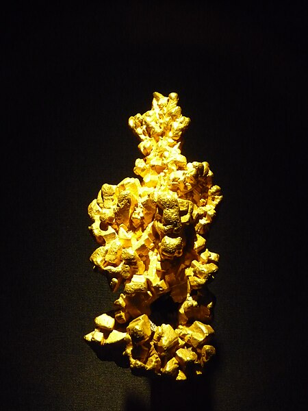
The largest deposits of gold on Earth are found in ancient turbidites that include the Witwatersrand of South Africa and the Abitibi found in Canada in both Québec and Ontario. By definition a Turbidite is a landslide that occurs on a continental slope of a continental landmass where the erosion products of the continent eventually work their way to the abyssal plain at the bottom of the ocean that can be several kilometers deep.

Turbidites start at the edge of the continental shelf and can be caused by several different geological phenomena. They are deposited by a special type of water flow called a Turbidity Current that can be started by an earthquake, a powerful oceanic storm or in some cases just by the amount of material that collapses in on itself. The turbidity current contains not only water but suspended debris that causes it to flow out of town little slow but a speed that exceeds that of water itself because the current is also carrying suspended particles. Depending on the height of the slope the speed that it flows can reach as much as 70 km/h.

Once this flow reaches the bottom of the slope it quickly loses its forward speed and as it does drops off particles according to their density. It has such a high specific gravity of more than 19 gold is one of the first things that is dropped from a turbidity current. The finer particles and spread out over the abyssal plain of the ocean extending across the abyssal plain for hundreds of kilometers. In many cases at the edge of the flow the finer particles may only be a few millimeters thick, but over time this can actually be built into deposits of great thickness.

Mostly gold of the Turbidite deposit will say relatively close to the edge of the continent. Examples of these Turbidite flows are found in several places in the world one of the classic examples is the MegumaTerrane of Nova Scotia.

Some of the metals found in this environment include gold, silver, tungsten and antimony.  In western Connecticut the Rowe schist is an example of a metamorphosed turbidite.  This formation extends from northern Massachusetts almost to Long Island Sound in Connecticut.  Over the years reports of gold have been rumored about with this formation, but what is lacking is substantial proof i.e. no core drilling.

A capsule description of a turbidite deposit is gold-quartz veins, segregations, lodes, sheeted zones that are hosted by fractures, faults, openings in anticlines, synclines, along bedding planes in the turbidites and those that are associated with poorly sorted clastic sedimentary rocks.

These rocks are typically found close to the margins of continents or in back arc basins.  These rocks were typically deposited in submarine troughs, periarc basins, foreland basins and other remnant oceanic basins.  One feature that is typical of these rocks is multiple deformation events accompanied by metamorphism.  They show evidence of being thick sediment sequences displaying both deformation and are metamorphosed.  Although there can be some igneous rocks found in one of these deposits they tend to be quite rare and are usually present as pegmatites.  In some cases there are younger granitic intrusions associated with these rocks raising them to be raised to greenschist, but in some cases can reach amphibolite grade metamorphism.

The ore mineralogy of one of these deposits whether it is principle or subordinate includes native gold, pyrite, arsenopyrite, phyrottite, chalcopyrite, sphalerite, galena, molybdenite, bismuth, stilbite, bornite and other sulfosalt minerals. These minerals generally have a low sulfide content of less than 2.5%. The usual minerals found in association with these ore minerals are Quartz, carbonates, feldspar and chlorite.

When rocks of this type are discovered in glaciated terrains they may undergo deep weathering where alluvial recycling may produce rich placer deposits, such as in the Bendigo region of Australia.

There is several factors that control the ore deposits that are often found in fold crests, discordant veins and tension gashes. In some cases such as the in the Bendigo there is a relationship between ore deposits in the amount of graphite that is found in the country rock. The structural control is often extended to a district causing a scale alignment of deposits. Sometimes the veins appear confined to a specific stratigraphic interval that is often near to a change in stone type. Sometimes a more subtle relationship occurs lower deposits more closely related to the upper portion of the turbidite as of the magma district of Nova Scotia.

Because the low sulfide content, the majority of Quartz veins houses most geophysical methods of geophysical exploration to become 
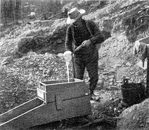
ineffective it is often necessary to resort to the more usual prospecting techniques that are often accomplished with a gold pan by tracing the deposit.

In the deposit of this kind is not unusual to find deposits that range from a 50 g per tonne. Many of these are attractive targets for exploration as many of them are world class deposits.

Deposits of this type become incorporated into continental land masses with the death of an ocean by two continental masses colliding and the turbidite deposits are squished between the continents causing the turbidite to become incorporated into the mountain range that is a result of the collision. 

Tuesday, July 3, 2012

Gold Occurrences in Burkina Faso


Map of Burkina Faso  -  CIA


In the past 40 years there has been a great deal of interest in gold mining in Burkina Faso. This is a country that is very geologically rich with the Poura region alone accounting for over 25 tonnes gold. As of 2003 the government brought about a new Mining act and immediately after there were more than 30 companies that have undertaken exploration projects in the country. They also created five new mines that are on the point of full production.

As demonstrated by the Abitibi region of Canada some of the richest gold mines in the world are located on greenstone belts.  In Burkina Faso greenstone belts cover about 3,000,000 km² of West Africa the Burkina Faso accounted for approximately 21% of these greenstone exposures. There are about 13 international mining companies that are active in this area now. .

As many as 13 international mining companies are working in the country mainly in the Greenstone belts. These belts account for over 21% of West Africa's Greenstone belt exposures that house on the world's most prolific gold mines. Some of these mines are capable of producing over 100 thousand ounces of gold per year. Much of this gold is produced by the heap leaching process and probably accounts to more than 1,000,000 ounces per year. Although some of these are producing mines, more of them are exploration projects that have been ongoing for some time.

All of the United Nations development program and Burkina Faso indicates that the early Proterozoic (Birrimian) Greenstone belts located at Boromo and Hound consists of steeply dipping volcanic and volcano-sedimentary units that have been intruded by the Eburnean granitoids there about 2 billion years old that have undergone incipient to low grade greenschist metamorphism. Many of the former gold prospects and mines are found in the Greenstone belts including the spell Poura vein gold deposit and the Dossi shear zone prospects. Much of gold that is discovered is associated with scheelite, calcium tungstate that is an ore for the metal tungsten.

Gold mining is one of the newest stories in Burkina Faso in recent years where the gold mining industry has been developing apparently inexhaustible resources.  There are many Australian companies that are already there searching for gold.  Many are finding it.

Most of the primary gold deposits are derived from metamorphic rocks that were developed from auriferous rocks that were eroded away long before the placer deposits bearing them were metamorphosed in the older volcanic and volcano=sedimentary rocks.  In this they are similar to the rocks found in the Witwatersrand district of South Africa and the Abitibi greenstone belts of Canada.

Monday, June 18, 2012

Gold Occurrences in Botswana


Mining in Botswana


Although gold is mined in Botswana since the early 1990s diamond production has led the pack with most of the diamonds produced were of gem quality.  This made the country the world’s leading producer of diamonds by dollar value.  Other minerals produced included gold, copper-nickel matte and soda ash.  During 2005, mining accounted for about 38% of the country’s Gross Domestic Product (GDP) with more then 50% of the government’s revenue coming from the mining industry.

Almost two thirds of Southern Africa including Botswana is composed of rocks of the Karoo Supergroup and most of the rest of Southern Africa.  The rocks are deposited in a series of basins in which the deposits had their origin in the formation and breakup of Pangea. The strata in the main crew consists mainly of shales and sandstones that record an almost continuous sequence of marine deposits ranging from glacial to terrestrial the presentation from the late Carboniferous through the early Jurassic for a period of about 100 million years.

The sediments accumulated in a retroarcforeland basin, these sediments are called the named Main Karoo with a thickness of about 12,000 km. They are overlain by basaltic lavas of the Drakensberg group. The basin was formed by the subduction and orogenesis that occurred along the boundary of Gondwana and the Panthalassan Sea, paleo – Pacific. The basalt layers are approximately 1.4 km thick.

A subsidiary of Gallery Gold called Mupane Gold operated the Mupane gold mine that was located about 30 km south of Francistown. This gold came from the Tau pit, and after mid-year production came from the oxide zone of the Tholo pit. Gallery gold continued exploring other gold prospect in the area of the Mupane mine including several other prospects.

One company suspects there are outlaying members of the Witwatersrand underlying parts of the Karoo formation, but that are and there is an active drilling program that is being undertaken.

Wednesday, June 13, 2012

Kitchen Utensils used for finding Gold


Many of these things can be used in the search for gold, but not all.
Photo by Jeppestown


About the last thing in the world you would expect to use in the hunt for placer gold are ordinary kitchen utensils. Just think about that some of the most useful tools in the hunt for Gold are nothing more complicated than a spoon, knife and fork along with several other common things that can be bought at a kitchen supply store.

One of the most useful things you can have as nothing more than a simple plastic colander. This is used to separate large stones that would normally go into your gold pan before they ever get there. The colander is used by placing it over a gold pan and filling it with stream gravel then pouring water over it causing the smaller particles to come out through the bottom into the Gold pan. You can then throw away the larger stones, but examine them first to be sure they do not contain a gold nugget.

Another useful kitchen gadget is a wide mesh sieve you can actually set up in the gold pan below the colander this serves to separate even more of gold bearing sand from the larger particles. The material that is caught by the strainer is retained for future panning to recover any larger particles of gold.

Although a gold pan or even better a set of gold pans are nice to have but they are not really necessary because the author has actually used plastic food containers to pan for gold. No we ever set a gold pan had to be round!

The spoon, knife and fork are used to dig around in places that are too small to use a regular shovel. This is especially true of places like crevices in rocks. In the same vein one of the most useful tools for the recovery of gold is a large serving spoon that is also used in small places that are also too large for shovel.

One of these plastic food containers can be used as a gold pan.
Photo by Stuart Spivack


Most of the gold panning kits that are now on the market include a snuffer bottle that is used to suck up small pieces of gold that are too small to be picked up by the fingers. You can use a turkey baster to do the same thing although it is a little large and cumbersome but actually works better is an ordinary eyedropper. Some kitchen supply stores supplying these things made from plastic as large as 5 ml, or 1 ounce.

Your homemade gold panning kits should also include a 10 X. magnifying glass and a pair of sharp pointed tweezers. This collection along with a conventional gold panning kit should serve in just about any situation that you find yourself in your hunt for placer gold. Who knows you may even find some other devices in your kitchen supply store that you may also find useful.

References:

This article is coming from personal experiences by the author over many years of panning placer gold.

If you would like to learn more about gold please click here!

How to Build a Gold Rocker Box:


A gold rocker box in use


A gold rocker box is a device that efficiently recovers gold from river sand and gravel that is capable of processing more gold per hour then a gold pan.  Its invention was during the Georgia Gold Rush that predated the California Gold Rush by several years.  During the days of the Forty-Niners the rocker box was considered more important then the gold pan.  It was also important during the Klondike Goldrush because the miners were able to use the rocker box on higher stream banks because it used far less water then the conventional gold pan.

The Gold Rocker Box was a slightly more complex way of producing gold that could easily be built in the field by the average miner from rough sawn lumber.  It also had the advantage of being usable by one man.  It was built in two parts; the upper part was a box that acted as a grizzly separating the larger stones from the lower part where the smaller sand and gravel went to be processed. 

In essence the lower part was a sluice box from four to five feet long, and about a foot wide.  This part of the box was equipped with a set of cleats along the bottom of the sluice to catch the gold particles, and let the lighter load of gravel run out the lower end of the sluice box as waste.

The upper part of the gold rocker was a shallow wooden box with a one half inch screen that acted as a grizzly to remove the larger stones from the gravel that was passed through it on the way to the sluice box.  The miner discarded the larger stones, but first examined them to be sure he was not throwing out any gold nuggets.

A piece of canvas that went from the back of the upper box that was attached to the lower box assured that the gravel was properly dispersed into the sluice box.  This device has survived the test of time as the big dredges often used a rocker box to finish off the concentrate of gold and other stream heavies.

To build a rocker you start by building the upper box first this is about eighteen inches by twelve inches in size, and about four inches deep.  Then a lower sluice box is constructed that is from four to five feet long, a foot wide, and about four inches deep.  The upper box is attached to the lower box with four one x twos that are about a foot long.  A piece of canvas is attached to the rear of the upper box, and is angled down to the lower box and attached at the point where the upper box ends.  The lower box is equipped with a series of wooden cleats that catch the gold from the gravel that is being passed through. 

There is also some kind of a one x two attached to both of the boxes so that the miner is able to rock the device back in forth sideways while he is pouring water in through the upper box.  The whole device is elevated from the ground with a set of legs about four inches high that are attached to the sides of the lower box.  These legs are joined together by a wooden frame that is attached to the bottom of the legs.

In use the upper box is filled with gravel by the miner, then he pours water by the dipper full washing the gravel down into the lower box.  As he adds the water he rocks the whole device back and forth so the gravel falling through the grizzly is spread evenly in the lower box, and is thoroughly washed.  The gold, if any, collects behind
 the wooden cleats in the bottom of the lower box to be removed after a large quantity of gravel has passed through the device.  The larger stones that stay on top of the grizzly in the upper box are discarded, but examined first so you don’t throw away any gold nuggets.

The rocker box finds many uses in prospecting as it is able to separate any heavier material from lighter.  It is used for the panning of platinum group metals as well as the heavier gemstones like diamonds and sapphires.

References:


Tuesday, June 12, 2012

Outlaw Gold


Illegal Gold Mining in Africa


Outlaw Gold is not something left over from the days of the Wild West it is an illegal method of mining gold that goes on today. It is especially prevalent in the countries of South America also this practice can be found all over the world. It is often used in financing rebellions and terrorism on a global scale.  It's not only goal these illegal miners are seeking they also hunt out diamonds and other precious commodities including trees and raising illegal cattle.

It isn’t the uncontrolled damage they do to the earth itself, but it is also the collateral damage by destroying the rain forest and polluting the earth with the chemicals they use for recovering gold.  These highly dangerous chemicals include cyanide and mercury that are released into the environment.  These chemicals are used commonly by outlaw miners, than released then they are released as contaminants.

One of the areas being badly affected is the Amazon rainforest in Brazil, Columbia, Ecuador, Guyana, Peru and Venezuela where large areas are being laid waste.  With large areas are being mined by outlaw gold miners being driven by the ever increasing price of gold as investors try to find shelters in commodities rather then the stock market.  Gold futures have recently traded for over US$1,600 for delivery in December.  Gold recently reached a record high on September 22, 2011 of US$1,923.70 per troy ounce. (31.1 grams/ounce).  Many gold experts expect gold to rise to US$2,000 per ounce by years end.

Outlaw gold mining has increased in the rain forests of the Amazon Basin and other parts of the world that have mineral riches to the extent that in many places in the world the situation has gotten out of control.  In some of the areas affected the increase of illegal mining activity has rose six fold in recent years.  Brazil it the exception to the rule since they have better law enforcement policies.  It is still a problem for Brazil, however with no easy solution.  Most of the damage is caused by drilling and blasting causing deforestation and the use of mercury by the miners that pollutes both the air and water of the affected area. 

The large mining companies are not to blame for this situation, rather it is the outlaw companies that do not apply modern mining methods and in many cases are quite primitive.  As a consultant to a mining operation in South America I am only too well aware that in just the practice of blasting many of these operators are working like it was still the 19th century where a blast is initiated with a cigar and length of fuse.  There are far better methods for this then a stogie.

Thursday, June 7, 2012

Gold Occurrences in Benin


Map of Benin


Mineral resource development is controlled by the Office BĂ©ninoise des Mines (OBEMINES). Benin has been revising its mining laws in order to attract foreign investment.

Benin has gold, iron ore and phosphate potential and has awarded several exploration licenses for gold exploration in the country to foreign investors. There are deposits of brick and china clay, feldspar, the Loumbu Loumbo low grade iron ore deposits and the Mekrou phosphate deposits. The development of the Loumbu Loumbu and Mekrou deposits hinges on the proposed development of a hydro electric power scheme that is to be constructed on the Mekrou River. Gold mineralization has been identified in the Atacora and Alibori regions, where hard rock and alluvial deposits are known to exist. At Alibori, a 350 km2 prospective area includes alluvial and vein hosted gold occurrences.

Major sources of alluvial gold and diamonds can be found in the Birimian rocks that are found in Ghana, the Ivory Coast, Mali and Burkina Faso   These rocks derive their name from the Birim River thay are one of the main tributaries of the Pra River of Ghana.  The same rocks also contain the country’s most important diamond deposits.  Diamonds are produced in Ghana and Mali that are the second and third largest producers in Africa.

The gold and diamond bearing rocks are called the Birimian Terranes that are composed of a mix 0f meta-volcanics, meta-sedimentary and rocks that are plutonic in nature.  Almost half of the rocks found in the southern part of the West African Craton are alkaline granites.  These rocks formed in a period of about 50 million years between 2,200 and 2,100 Ga years ago.

It is believed the Birimian Rocks that stretch across the countries that are to the north of the Gulf of Guinea formed when a series of island arcs were driven together forming a series of parallel belts that trend to the northeast in a belt that is about 40 to 50 kilometers wide.  Many of the volcanic rocks have been metamorphosed into greenschist facies.

Although most of the gold mined in the country is recovered by artisanal miners from the Birimian Terrane it has recently discovered more gold is found in the overlaying conglomerate of the Tarkewian formation.  The gold does not have its origin in the Birimian Terrane. 

There are several varying theories about the origin of the Birimian Terrane.  One theory holds the rocks were formed by the collision of the Archean Cupixi-Carajas craton of the Southern Guiana Shield.  Another theory that is more widely accepted is the terrane has it origins in a mid-oceanic series of volcanic island arcs that formed a crust that was then thrust faulted onto the West African Craton that was later compressed into a series of folds.

During the recent civil war in Benin foreign investment literally dried up, but with the onset of peace it is beginning to flow once again.