Total Pageviews

Tuesday, June 12, 2012

Outlaw Gold


Illegal Gold Mining in Africa


Outlaw Gold is not something left over from the days of the Wild West it is an illegal method of mining gold that goes on today. It is especially prevalent in the countries of South America also this practice can be found all over the world. It is often used in financing rebellions and terrorism on a global scale.  It's not only goal these illegal miners are seeking they also hunt out diamonds and other precious commodities including trees and raising illegal cattle.

It isn’t the uncontrolled damage they do to the earth itself, but it is also the collateral damage by destroying the rain forest and polluting the earth with the chemicals they use for recovering gold.  These highly dangerous chemicals include cyanide and mercury that are released into the environment.  These chemicals are used commonly by outlaw miners, than released then they are released as contaminants.

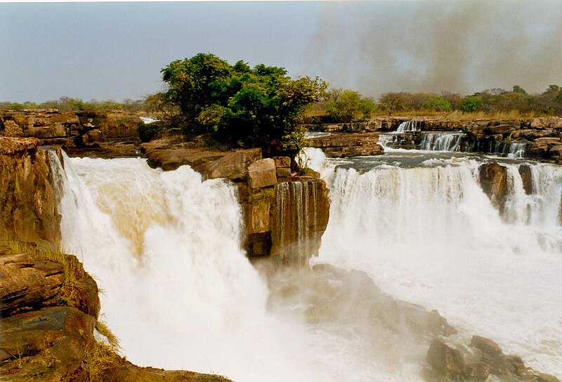
One of the areas being badly affected is the Amazon rainforest in Brazil, Columbia, Ecuador, Guyana, Peru and Venezuela where large areas are being laid waste.  With large areas are being mined by outlaw gold miners being driven by the ever increasing price of gold as investors try to find shelters in commodities rather then the stock market.  Gold futures have recently traded for over US$1,600 for delivery in December.  Gold recently reached a record high on September 22, 2011 of US$1,923.70 per troy ounce. (31.1 grams/ounce).  Many gold experts expect gold to rise to US$2,000 per ounce by years end.

Outlaw gold mining has increased in the rain forests of the Amazon Basin and other parts of the world that have mineral riches to the extent that in many places in the world the situation has gotten out of control.  In some of the areas affected the increase of illegal mining activity has rose six fold in recent years.  Brazil it the exception to the rule since they have better law enforcement policies.  It is still a problem for Brazil, however with no easy solution.  Most of the damage is caused by drilling and blasting causing deforestation and the use of mercury by the miners that pollutes both the air and water of the affected area. 

The large mining companies are not to blame for this situation, rather it is the outlaw companies that do not apply modern mining methods and in many cases are quite primitive.  As a consultant to a mining operation in South America I am only too well aware that in just the practice of blasting many of these operators are working like it was still the 19th century where a blast is initiated with a cigar and length of fuse.  There are far better methods for this then a stogie.

How the Geological Theory of Uniformitarianism affects Everyone's Future


James Hutton the founder of the Theory of Uniformitarianism 


It was during the mid-17th century that the Archbishop JamesUssher of Ireland and a notable biblical scholar used the Bible to determine the age of the earth based on the generations described in the Bible. From carefully counting the number of generations described in the Bible Ussher it determined that the earth had been created during the year of 4004 BCE. This may not indicate the actual age of the earth although it does tell how many generations are described in the Bible.

A little more than a century later the Scottish geologist James Hutton who is called the father of geology came to the conclusion the earth was much older then it was believed to be by Archbishop Ussher. Working out of the University of Edinburgh Hutton laid down one of the basic tenets of geology when he suggested that the processes occurring today for the same processes that had acted in the past, and would be the same processes working in the future. This is a polite way of saying, “Nothing ever changed and nothing ever will.”

It was in 1785 that Hutton wrote, “we find no vestige of a beginning, no prospect of an end.” James Hutton, 1785.  100 based his theory on was the slow, natural processes that he is observed in the landscape of Scotland. One of the first things he realized was that if a stream was flowing for enough time it would create a valley. He also observed that ice could a erode rock, that sediment could accumulate in such a way as to form new landscapes. I'm also realized that the effects of great disasters on the face of the earth such as earthquakes, asteroids, volcanoes and floods are nothing more than a part of the regular cycle of earth processes.

The entire theory is postulated by Hutton known as the Theory of Uniformitarianism is based on the slow, natural processes that occur on the face of the earth cussing him to speculate that millions of years would've been required to form the surface of the earth into its present state. This theory was used to give rise to a new science that was closely related to geology that is called, “geomorphology.” This is the study of landforms and how they were created.

Hutton himself is not a very good writer that is considered by many to be unfortunate, but his paper of 1785 suggested an entirely new theory of geomorphology that is the study of landforms and their development. Another sentry was to pass before another geologist Sir Charles Lyell. Whose money and metal book the principles of geology that was published in 1830 popularized the concept laid down by Hutton in his earlier work on uniformitarianism.

Today the age of the earth is estimated to be about 4.50 5 billion years old with a planet having had enough time for the slow, continuous processes of geology to mold and shape our as we now know.  In the same vein we know that sudden disasters have also had some very profound impacts on our landscapes.

In 1994, the US National Research Concil will stated:

“It is not known whether the relocation of materials on the surface of the Earth is dominated by the slower but continuous fluxes operating all the time or by the spectacular large fluxes that operate during short-lived cataclysmic events. (Davis, 18).”

Today it is recognized that the water that falls on those writing during a storm slowly erodes the soil, wind is capable of moving the sands of the desert's, floods can change the course of a river while the theory of uniformitarianism unlocks the keys of our distant past and predicts the future and is the controlling factor for everything that occurs today.

For further reading about this subject consult:

Davis, Mike. Ecology of Fear: Los Angeles and the Imagination of Disaster.
Lyell, Charles. Principles of Geology.
Tinkler, Keith J. A Short History of Geomorphology. Barnes & Noble Books, 1985.

Tales of the Devil: Origin of the Rowe Schist

The earth movements that affected the Appalachian Mountains after the Taconic Orogeny   USGS

During the late Cambrian and early Ordovician a series of turbidite flows came down the continental slope of the North American craton.  This was the origin of the Roweschist formation.  Turbidites are also good sources of gold ore.  There are several examples of this kind of formation worldwide with the Witwatersrand of South Africa being the most notable.  Much of the gold ore from Timmins, ON is another example as are many of the deposits of the world.  To date the Witwatersrand has produced around 40% of the entire world’s gold supply in the past 40 years.  The gold mines found here are some of the deepest in the world that now are approaching 13,000 feet deep.

Earth movements associated with the Taconic Orogeny during the late Ordovician caused this layer of turbidite to be shoved to its present location close to the Iapetus Suture zone that locally in Connecticut and New York is called Cameron’s Line under differing names it reaches to the mountains of western Norway.  It is truly one of the largest suture zones on earth.  By definition a suture zone is also a subduction zone where rocks of oceanic origin are forced under the continental margin.  Cameron’s Line is about two miles west of the Rowe schist the formation that underlies the property belonging to the finder of the Whodunit Mine.

According to the USGS the following illustration graphically explains the Taconic Orogeny an Alpino type orogeny, a long narrow belt of mountains that formed the Taconic mountain range.  This is the orogeny that initiated the first of several mountain building events that occurred in the Northern Appalachians.  This is the orogeny that had the greatest effect on the Litchfield site.

The site itself is composed of a series of turbidite flows that flowed down the continental slope into a back arc basin behind the island arc.  This was composed of the sand and mud component illustrated in the first of the illustrations shown of the below diagram.  The Hoosac Schist on the landward side of Cameron’s line is represented by the portion marked sand.  The continental crust is represented by the Precambrian rock north and west of the site on the landward side of Cameron’s Line. 

Cameron’s Line is where the Hoosac schist and the portion marked sediment meet in a long suture line that extends from Staten Island, NY that was broken in half after the Atlantic Ocean opened during the Mesozoic and after passing through Ireland, Scotland eventually ends in the mountains of northern Norway.

When the Taconic Orogeny ended the mountains that rivaled the Himalayas in height were completely eroded away to a flat plain we know as a peneplain.  There were small mountain building events that occurred during the Silurian that although they affected the local area were so small as to be hardly noticed.  The next big event that affected the eastern seaboard occurred during the Devonian called the Acadian Orogeny.


The Acadian Orogeny produced a different type of mountain range that was much broader then the Taconic Orogeny that to geologists is a Hercyanian type orogeny that was caused when Europe sideswiped the North American Continent.  It was during this event that the Rowe schist was intruded with molten magma causing it to become a type of rock called granofels.  This action caused many secondary minerals to be deposited in the schist ilmenite being the most prominent.  The event also caused further deformation to the Rowe schist.

At the end of this orogeny the Rowe schist has stayed above sea level unlike at the end of the Taconic orogeny as the rocks were eroded smooth the ocean came back to cover the land with ocean water.

Land affected by the Acadian Orogeny.  The original path of Cameron's Line is depicted in red. 


For the most part the only Orogenies that affected the local area were the Taconic, the Silurian (?) and the Devonian.  The later Orogenies affected the lands to the south and east.

Thursday, June 7, 2012

Gold Occurrences in Benin


Map of Benin


Mineral resource development is controlled by the Office BĂ©ninoise des Mines (OBEMINES). Benin has been revising its mining laws in order to attract foreign investment.

Benin has gold, iron ore and phosphate potential and has awarded several exploration licenses for gold exploration in the country to foreign investors. There are deposits of brick and china clay, feldspar, the Loumbu Loumbo low grade iron ore deposits and the Mekrou phosphate deposits. The development of the Loumbu Loumbu and Mekrou deposits hinges on the proposed development of a hydro electric power scheme that is to be constructed on the Mekrou River. Gold mineralization has been identified in the Atacora and Alibori regions, where hard rock and alluvial deposits are known to exist. At Alibori, a 350 km2 prospective area includes alluvial and vein hosted gold occurrences.

Major sources of alluvial gold and diamonds can be found in the Birimian rocks that are found in Ghana, the Ivory Coast, Mali and Burkina Faso   These rocks derive their name from the Birim River thay are one of the main tributaries of the Pra River of Ghana.  The same rocks also contain the country’s most important diamond deposits.  Diamonds are produced in Ghana and Mali that are the second and third largest producers in Africa.

The gold and diamond bearing rocks are called the Birimian Terranes that are composed of a mix 0f meta-volcanics, meta-sedimentary and rocks that are plutonic in nature.  Almost half of the rocks found in the southern part of the West African Craton are alkaline granites.  These rocks formed in a period of about 50 million years between 2,200 and 2,100 Ga years ago.

It is believed the Birimian Rocks that stretch across the countries that are to the north of the Gulf of Guinea formed when a series of island arcs were driven together forming a series of parallel belts that trend to the northeast in a belt that is about 40 to 50 kilometers wide.  Many of the volcanic rocks have been metamorphosed into greenschist facies.

Although most of the gold mined in the country is recovered by artisanal miners from the Birimian Terrane it has recently discovered more gold is found in the overlaying conglomerate of the Tarkewian formation.  The gold does not have its origin in the Birimian Terrane. 

There are several varying theories about the origin of the Birimian Terrane.  One theory holds the rocks were formed by the collision of the Archean Cupixi-Carajas craton of the Southern Guiana Shield.  Another theory that is more widely accepted is the terrane has it origins in a mid-oceanic series of volcanic island arcs that formed a crust that was then thrust faulted onto the West African Craton that was later compressed into a series of folds.

During the recent civil war in Benin foreign investment literally dried up, but with the onset of peace it is beginning to flow once again.

Wednesday, June 6, 2012

Tales of the Devil: The Whodunit Mine


Typical Landscape at the Whodunit Mine
Photo by P. L. Chadwick


No this isn’t a tale of the nether regions it is the story about the discovery of a long abandoned mine in western Connecticut.  For lack of a better name we might as well call it the “Whodunit Mine.”  The mine is on private property, and its owner is in the business of raising big dogs.  He will loose the hounds on anyone who goes trespassing on his property, so let that be a warning.

The old mine was discovered by the owner when he wanted the zoning classification of his property changed from residential to farming.  There were several old pits in the ground the zoning enforcement officer wanted filled in as part of the change.  This got the curiosity of the owner that led to the discovery of several acres covered with pits and several hundred feet of trenching giving the property the appearance of a battlefield.

The site also contains timber rattlesnakes
Photo by Trisha M. Shears


Somewhere in the process last April 2012 he contacted me because I operate a school for prospectors teaching the fundamentals of prospecting that I try to tailor to the individual.  The owner already knew how to pan for gold, what he was really curious about was what he had on his property.  We made a trip to the site where we looked the site over and discovered plenty of evidence of prior mining activity with many prospecting pits and several hundred feet of trenching.  This activity covered several acres of the property.  From prior experience I know what this kind of work costs in money and labor.

In the past I had some involvement with Robert J. Altamura who worked for the Connecticut Geological and Natural History Survey when he prepared a map of the Bedrock Mines and Quarries of Connecticut.  Since I had a copy of the map and its accompanying booklet I checked and the site wasn’t on the map.  With that I contacted Margaret Thomas the state geologist and told her I’d found an unlisted mine.

Another creepy-crawler found on the property is the copperhead
Photo by Trisha M. Shears


Because the owner was a contractor he had some construction equipment including a backhoe that he used to explore the old mine.  He called me on the phone one morning in early May to tell me he had dug into what turned out to be an apparent mineshaft and had discovered many old bottles and other artifacts.  I told him to stop digging and I’d contact the state archeologist.  The state archaeologist told me he couldn’t come until May 24.

In the meantime I also contacted the Yale Peabody Museum who put me in touch with their mineral collection manager.  A bit later I contacted the geology department chairman at Hofstra University a personal friend to tell him what we had discovered.  Ultimately both the mineral manager and the chairman of the department agreed to come to the site on May 24.

What happened on the 24th was the meeting of a blue ribbon panel consisting of one archaeologist, three geologists and two engineers.  The net result of the meeting was we couldn’t determine what they had been mining.

The mine contains the following minerals: amphibolite, beryl, corundum, ilmenite, kyanite magnetite, pyrites talc and other minerals that are yet to be identified.  We also found one small speck of gold.

My own theory of this is:

The digging probably happened in the 1850’s after somebody came back from the California Gold Rush and decided there was gold on this property and went looking for it.  The debris filling the mineshaft has been dated to the post Civil War Era by the state archaeologist.  The mineshaft yielded what appears to be a cast iron ladle that could be used in assay work.

This tale is going to be continued!

Sunday, June 3, 2012

Gold Occurrences in Angola


Tazua Falls on the Rio Cuango is one of the richest diamond and gold rivers in Angola
Photo by Brian Harrington Spier


Gold and base metal potential remains in Angola, but because of the ongoing civil war in Angola much of this potential remains unexploited.  Even though the country has been wracked by this conflict mining still provides the country with some foreign exchange with about 98% of it coming from diamonds.  The rest of the countries earnings are from oil.  Before the civil war Angola was an important producer of gold and other metals.  Because of the ongoing civil war it is difficult to reach much of the country from the outside.  No doubt there are world class deposits of gold waiting to be discovered in Angola.

Geologically Angola was once part of Southern Brazil until the Atlantic Ocean commenced opening during the Triassic period 220 million years ago; today the two countries are separated by the Atlantic Ocean.

Twelve billion barrels of oil have been found in the deep waters off the coast of Angola since it was first discovered in 1955.  Officials at Sonangol, the country’s oil company say this is only a small part of the total potential.

Upper Proterozoic Fold Belts of the Pan African are found along the margins of Angola’s Precambrian shield.  Among the most important are the West Congo, Damara and the Maiombe-Macongo.  This fold belt displays the occurrence of both gold and base metals along with a wide variety of industrial minerals.

The Lower Protozoic and Archean rocks are composed of the Angloan, Maiombe, Cassai and Bangwelo shields along with the granitic, gneissic rocks sedimentary (greenstone) belts from the Angolan, Maiombe, Cassai and Bangwelo shields and the Kwanza meta-
Volcanic sedimentary (greenstone) belts are present in the south-central part of the country as the Cassinga and Menonque greenstone belts.  These rocks go on to the Cunene basic to ultra basic complex that occupies more then 20,000 sq. km in southwestern Angola.

Angola is blessed with mineral riches with most of the rivers flowing down from these areas bearing lode gold and there is plenty of areas bearing lode gold waiting to be explored.

Saturday, June 2, 2012

Gold Occurrences in Algeria


Image of Pangaea before it broke up beginning in the Triassic 220 million years ago


Gold has been found in the Atlas Mountains of Algeria since early times predating the Romans.  In southern Algeria is the 1,425 square kilometer tract of the Tirek-Amesnessa gold concession of GMA Resources Plc that owns 52% of the concession with the remainder 48% belonging to Sonatrach AVAL, the giant Algerian oil & gas giant.  The companies have recently constructed a new heap leach facility there.  They are also conducting an extensive exploration program covering the entire concession.

During the late Permian Africa collided with North America causing the southern Appalachians to be thrust skywards into mountains that were higher then the Himalayas at the time the Little Atlas Mountains of Algeria were part of this mountain mass.  This set of tectonic mountains completed the building of the supercontinent Pangaea.  They were later separated when the supercontinent broke up during the Triassic with the opening of the Atlantic Ocean.  There is a feature in the Southern Appalachians and the Little Atlas Mountains called the gold belt that in North America was the home of America’s first gold rush.

The Amessmessa located in the Little Atlas Mountains is part of this gold belt that was transported across the Atlantic Ocean by the action of tectonic plates to where it is today.  It has been estimated this deposit could generate gold at the rate of 200,000 to 300,000 ounces of gold per year.  This is going to be hard rock mining that is going to require massive amounts of mechanical equipment.

The Atlas Mountains run for approximately 1,300 miles (2,090 km) through the Maghrib countries of Morocco, Algeria and Tunisia.  The mountains extend from the Atlantic Ocean, south of the Agadir, to the Mediterranean Sea near Tunis.  The Atlas Mountain systems comprises a series of roughly parallel ranges that go east to west that include the Anti Atlas, High Atlas, Middle Atlas, Saharan Atlas, Tell Atlas and other lesser ranges.  Some people think the Rif range running along the Mediterranean coast of Morocco is also part of the same system.

There are deposits of gold, silver, lead, zinc, iron, manganese, antimony, phosphates and oil found throughout these mountains.  Some of these many deposits have been worked since ancient times, others have only come into prominence in modern times.  Gold is found in many places as both hard rock deposits and as placer gold in the Wadis washing down from the mountains into the Sahara desert.  Many of these deposits have remained unexploited to this day.