Total Pageviews

Showing posts with label prospecting. Show all posts

Sunday, June 24, 2012

Rock Hounding, or where you can go beyond Prospecting


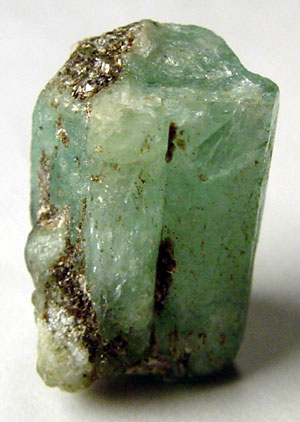
Uncut emerald one of the many members of the family of beryl minerals
Photo by Ryan Salisbury


Rock hounding is many faceted hobbies that make use of various earth materials as its objective.  Rock hounds can range in expertise from the rank amateur that collects pretty pebbles to world class experts on gemstones and minerals.  One of the branches of rock hounding is prospecting for gold and other precious metals.  There are many other fields of study that open to the rock hound as his level of knowledge increases.  Many rock hounds discover that over time rock hounding becomes a full time job.

One of the first things that have to be considered is the number of actual minerals there are, and of the latest count there were over 2000. Another thing that deserves a great deal of study is the number of minerals contained in each of the primary rack systems igneous, metamorphic and sedimentary. Each of these rocks systems contain some very specific minerals that are only found in one system. That being said has to be recognized that many mineral bridge more than one system. Probably one of the most outstanding examples of this is the occurrence of zircon they can be found in all three rock types.

Rhodocrosite from Argentina
Photo by Alberto Salguero


No doubt the most important thing most rockhounds want to learn is the identity of the different minerals they have found. This can be quite difficult considering the number of minerals that are recognized, but if you gold belt this systematically it becomes much simpler. All minerals have specific characteristics that are readily recognized that can take several forms. Many of these ways of recognizing minerals and trace their origin back to ancient times. The ancient Egyptians were quite adept at this practice and their knowledge of chemistry and mineral recognition was quite advanced.

There are a number of different ways of identifying a specific mineral among them are: hardness, color, specific gravity, transparency and fracture. One of the most accurate ways of identifying all minerals is by a process called x-ray diffraction spectrometry or what is commonly called a powder camera that is used by professional mineralogists. A powder camera admittedly is beyond the realm of rock hounds, but there are several tools that are still available to them.
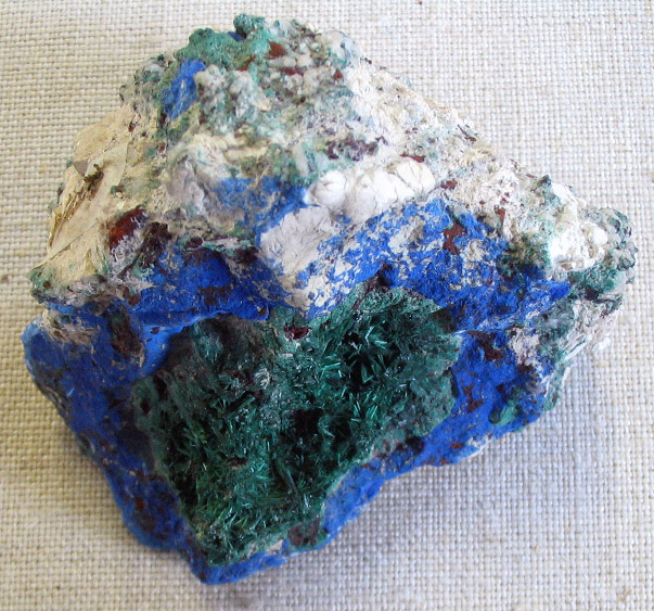
Azurite the blue mineral with malachite the green mineral from Russia
Photo by Aramgutang

The most common of these tools are the hardness testing kit that you can build yourself that are based on being able to scratch a sample. The hardness testing kit is based upon Moh’s Scale of Hardness that ranges from 1 to 10 with talc being the softest and diamond the hardest. Although you can purchase hardness testing kits you can easily make your own from readily available minerals. You can Google Moh's Hardness Scale on the Internet that will give you a list of the different minerals by hardness that are in the scale.

The next most important thing to consider is the mineral's specific gravity. The law of specific gravity was discovered by Archimedes in the city of Syracuse, Sicily during the days of the Romans. Each mineral is first weighed in the air and then weighed in water the difference between the two numbers is the specific gravity of the mineral. Once again a complete explanation of this can be found by Googling the phrase specific gravity.

Color and transparency are self-explanatory and most books on mineral identification are set up to show minerals by their color and chemical composition. Fracture is yet another important tool used in mineral identification.

Tuesday, May 15, 2012

Gold Occurrences in Bolivia


A scene from Potosi a famous Bolivian mining center.  Note the volcano in the background a source of gold deposits.
Photo by Idobi


Although Bolivia is noted for its tin production especially in the area around Potosi gold mining and prospecting proceeded at a brisk rate during the late 1980s.  Gold is found throughout the country with more then 300 cooperatives and over 10,000 prospectors producing gold.

Bolivia like many other countries in the world now faces a trade-off between economic growth vs. the environment.  The country derives much of its foreign exchange from the mining industry with zinc being its largest mining export followed by tin, gold and silver. As a result of this dilemma Bolivian mining companies have developed tighter rules with gold mining being an important source of foreign exchange for the country.  Things get difficult because Bolivian and U.S. environmental groups continue to fight prospecting and mining efforts because of their devastating effects on the local environment.

The practices of the mining industry leads to soil erosion combined with pollution of the country’s fresh-water resources.  This leaves the peons of the country torn between mining and jobs or protecting the environment that fails to bring Bolivia much needed jobs.

Mining is the mainstay of Bolivia’s economy with around 50% of its foreign exchange coming from this source.  The country’s private mining sector has continued to grow led by Canadian and U.S. companies.  The government has set aside a large area about 120 km north of LaPaz for gold mining and exploration.

There are plenty of active and extinct volcanoes in Bolivia to provide heat engines to drive the hydrothermal waters responsible for building gold deposits when the water reaches conditions that will precipitate the dissolved gold from solution.  This volcanic activity has given birth to extensive deposits of hard rock gold and abundant placer deposits in the country’s rivers and streams.  There is both artisanal and full scale mining in Bolivia, and it’s still ongoing.

Mining has been going on in Bolivia since the days of the Spanish conquest that began in 1524 and was mainly completed in 1833.  In those days after the conquest what is now Bolivia was known as “Upper Peru.”  When it was founded in 1545 as a mining center Potasi quickly started pouring immense mineral wealth into the coffers of the Spanish Empire it quickly became the largest city in the New World with a population larger then 150,000.  The Spaniards were mainly interested in gold it was later that Potasi became known for its tin deposits.  Mineral wealth continues to pour from Bolivia. .   

Wednesday, February 15, 2012

Nancy Twinkie goes Big Time

A DeHaviland Beaver like the ones we had except ours were on floats not skis.
Photo by Dave Bezaire & Susi Havens


Every summer after black fly season was over Kenny, Hans and I used to go prospecting in Northern Canada in the Arctic Archipelago.  By that time I had married Nancy Twinkie.  It turned out to be an excellent choice and Nancy had developed into a good prospector and part time gold miner.  When she got wind of us going up north again she let out a howl that almost took the roof off the house.  She wanted to go too!   She also made it quite clear there was no reason why she shouldn’t.  Besides she could even get in a TV Special about prospecting in the far north.  Well, you know how a woman is when they get their head made up?

Kenny, Hans and I had a powwow about this development where at first the other two didn’t want to hear anything about Nancy’s plans.  She only howled louder, I never realized how much noise such a little snippet of a girl could make when she didn’t get her way.  I soon found out, so we decided Nancy could go with us as the camp cook, besides that we were sick of our own cooking.  It left too much to be desired.

With that we started the long trek by car to Winnipeg where we left our planes during the off season.  When we weren’t using them we leased them to the charter service in Winnipeg so they kept earning us money when we weren’t using them.  We had a pair of DeHaviland Beavers, a big single engine plane with a pair of pontoons bigger then canoes.  They also came with Pratt & Whitney radial engines that if they weren’t dripping oil we wouldn’t use them.

While we were getting the planes ready and buying what prospectors supplies we needed, Nancy went shopping for food.  She bought the usual, but even some things to eat we would never even thought of.  One of the items she bought was a big bag of marshmallows; can you just imagine taking a bag of marshmallows on a prospecting expedition?  I thought I’d never live that one down!

We took off on the long trip north to Victoria making our first landing on the lake at Thicket Portage.  It felt pretty good to have Nancy along she flew with me; Kenny and Hans were in the other plane.  After getting gas we continued to fly north to Churchill were we laid over for the night.  Rather then spending money it was our habit to sleep right in the plane.  The next morning we took off and continued north to our next gas stop at Baker Lake.  From Baker Lake we continued on north to our final destination at Cambridge Bay where we finally set down on the bay.

Cambridge Bay is on Victoria Island at 69o north.  The Arctic was abloom with flowers, and although the black fly season was over there were swarms of mosquitoes that took their place.  This surprised Nancy because she hadn’t counted on mosquitoes, and can they make your life miserable.

This story is going to take several episodes so be sure you see the next one: Nancy Twinkie meets the Inuit

Friday, November 11, 2011

The Benefits of prospecting during Cold Weather

A snowy owl in flight during cold weather, one of the best times for prospecting.


The greatest benefit of prospecting during cold weather is there aren't any black flies around to gnaw on your bones. There are also many other benefits, probably the second most important is there aren't any mosquitoes around either. These two critters can make prospecting during the warmer month’s sheer hell. Another critter that is missing during the cold months is snakes. Many snakes are harmless, but the onesyou are apt to encounter while prospecting may not all be. It is the venomous snakes like copperheads, coral snakes, cottonmouths and rattlesnakes that can raise hob within any prospecting expedition.  For the most part even bears go into hibernation during the coldest months of the year. 

That leaves some other critters that might remotely be a bother, but only members of the deer family and the mountain lion are truly dangerous.  Usually deer try to avoid contact with humans, but during rutting season in the late fall male deer have been known to attack humans.  I once had a late fall encounter with a bull moose, a member of the deer family that could have been dangerous, but the moose didn’t like the smell of my companion that I’d been after for two weeks to take a bath.  The other dangerous animal is the mountain lion; they look upon humans as lunch.  Most mountain lions are confined to really wild areas in the western United States or the Florida Everglades.  They are very rare, but I observed one in Connecticut about thirty years ago.  According to the Department of Environmental Protection in Connecticut there weren’t any mountain lions in the state.  This spring one was killed on the Merritt Parkway, and another was observed by a canine control officer in northern Connecticut.

The perfect thing to go prospecting in during the winter.  Vehicles like this are used extensively for prospecting in Canada and other cold places.  This is a prototype that was built in Montana during the 1970s.
Photo by Gyre


The greatest benefit of cold weather prospecting is you can see so much further when the trees are bare.  One of the greatest problems facing a prospector is being able to find bedrock.  No leaves or other vegetation make it so much easier.  If you are panning for gold in a stream you can still do so just by wearing rubber gloves.  When I was prospecting in the cold weather I used to wear the bright red gloves that were covered with rubber, and were insulated.  They kept the cold water out, and the heat in.

It’s also much easier to get around in the bush or muskeg when the ground is frozen; in fact in some places where you want to prospect can only be approached during cold weather.  You don’t want to get into muskeg during warm weather, you’ll still be there.

Even if you are not out prospecting it is still a good time to plan your next expedition by studying the literature about the area where you intend prospecting, and laying your plans.  Remember there are plenty of other minerals worth looking for besides gold.

Wednesday, August 24, 2011

Gold Occurrences in Ontario


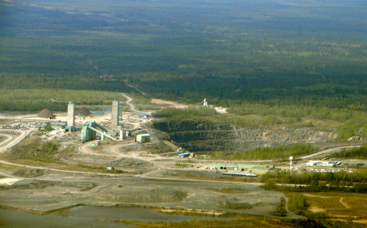
Kidd Creek Mine in Timmins Ontario   P199


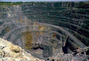
The City of Timmins lies about 600 miles north of New York City it is common knowledge to most Americans that the Gold Rush happened in California in 1849, but a far larger gold rush occurred in Porcupine Ontario fifty years later.  Porcupine was later incorporated into the Township of Timmins, but Porcupine still exists complete with a Tim Horton’s shop.  One of the mines, the Dome Mine is still producing gold over a century later from a vast open-pit mine.  The other mines are now closed, but in West Timmins they have recently discovered one of the largest gold deposits of the past century.  It appears they haven’t written the last chapter in the book about Timmins Gold.

Most of the gold found in Ontario is found in the so-called Greenstone Belts the largest of which is the Abitibi reaching all the way from Wawa on Lake Superior into Quebec past Val D’or.  From this one Greenstone Belt there are more then 160,000,000 ounces of gold that have been mined since its discovery in 1909.  This is only one of several Greenstone Belts in the province that has produced gold. 

Gold bearing belts are found in several other localities in Northern Ontario with other notable occurrences at Cochrane, Red Lake, Hemlo, Marathon and so many other places that prospecting for gold in Ontario is practically the same thing as carrying coals to Newcastle. Many of the VMS mines in Ontario produce gold as a byproduct.  One example of this kind of deposit is found in the Kidd Creek Mine to the east of Timmins that was the site of a famous discovery in 1963.  Most of the gold that has been found in Ontario is from hard-rock deposits.

Somebody has said that there has never been a single nugget of placer gold that has been found in the province.  According to an open file report by the Ontario Geological Survey there appears to be a considerable amount of float gold present in the glacial drift of Ontario.  It is probable that placer deposits have not had enough time to develop since the glacier melted.  At any rate the report covers about two hundred pages listing all kinds of places where placer gold and indicator minerals for kimberlites have been found in Ontario.  You can access this document online by going here.

According to the author’s prospecting friends in Ontario all the prospecting done in the province is in hard rock. With the amount of gold that has been discovered that really makes sense. It could be possible that what has worked in the past will work in the future. The possibility of placer mining has not happened because of the scarcity of alluvial gold. Although the Abitibi region of Ontario holds many lode mines, placer deposits are practically non-existent. The glaciers of the past million years took the gold laden soil south and deposited it in states across the American mid-west. These are from New York to Illinois.
Most of the gold of Ontario is found associated with the greenstone belts of the Abitibi and Superior Provinces that span the whole province from Manitoba to Quebec. It is thought that the gold was mobilized from the greenstones that are metamorphosed basalts by hot water. It was deposited in quartz veins that are often found near fault systems.
Another place that gold is found in Ontario is in beds of ancient conglomerate. An example of this type is a large piece of conglomerate on display on the lawn of the library in Timmins. This is probably an ancient placer deposit that has been fossilized. The stones in this piece show little or no sign of having been metamorphosed. It is an example of an Archean sedimentary rock.
Some of the other regions of Ontario that have produced gold is the area around Wawa and Marathon. The Western part of the province is also promising country to prospect. Prospecting in Ontario is not just limited to looking for gold. There is at least one active diamond mine in the James Bay Lowlands, as well as diamond bearing kimberlites found in several places in the province.
Diamonds are often found in the same rivers and streams that carry gold in their sand and gravel deposits. The largest diamond that was ever found in North America was found in a placer deposit.
There are plenty of other minerals that can be found in Ontario as well. These minerals might not be as glamorous as searching for gold, but in many ways they are more important in the modern world. Among them are copper, lead, zinc, nickel, iron, lithium, beryllium, niobium, tantalum and the rare earth elements. The platinum group metals are often found associated with copper, cobalt and nickel.
If there is anyplace where people have looked in Ontario for mineral wealth they have found it. The province maintains a very active geological survey that holds vast amounts of knowledge concerning the mineral wealth of Ontario.

Saturday, May 7, 2011

The Tools of the Trade by Raymond Kukkee, Prospector

Prospecting country in Northern Ontario this is a photo of Kakabeka Falls called the Niagara of Canada.  Ray lives in the town of  Kakabeka Falls, Ontario.
Photo by Hans Jurgen-Hubner


Raymond Kukkee has been a hard-rock prospector in Northern Ontario for over thirty years, and the following article is built on his experiences while prospecting. 

What you should take with you on a prospecting outing is always a good question. It's always better to have something and NOT need it, than to be 60 miles out on the trail wishing you did bring it along.
    
 Here's a list of what I usually take along on my day trips.  Remember I 'm going out in my truck and might be  dragging  a 4WD Quad along to save the feet too!

Even for a 2 hour walking trip, I take most of  the following tools and other helpful items,  but once out in the field  at times,  I may leave some  items  in the truck, depending on the outing:


•    A jeweler's loupe,  I use a 25x triplet
•    Topographic  and geology maps of area to be explored
•    Prospector's license*
•    Pad and pencils. Take extra pencils, they get lost easily. A compact  waterproof paper notebook is handy
•    A compass  (liquid-filled, good quality)  I use a Silva  or Brunton surveying type  c/w signaling mirror
•    A GPS unit capable of mapping,  projecting and tracking way points.    My present GPS is a Garmin GPSmap76CX, which is reliable and runs for a couple of days on 2 AA batteries.
•    Safety glasses for bashing rocks.  We only have ONE set of eyes so take care of them!
•     A compact first aid kit
•    A belt-carried hunting knife -6"   and / or a multi-tool type belt knife
•    A prospecting "pick" hammer. (In this area we have a special tool called a "Tweedie" tool named after Ron Tweedie, the inventor and maker.  It is a 36" short-handled   hammer with a 3" flat blade opposite that can be used both  for whacking rocks and grubbing, to remove moss/dirt for stripping.  (In prospecting that is convenient, it saves you bringing along a wide pick.)   At times it might be the only hammer you carry.
•    A sharp cold chisel  ½" x 12" long
•    A 4-lb short- steel- handled  "crack hammer"  unbreakable (Estwing) for serious sample removal.
•    Some paper to wrap special delicate specimens
•    Plastic sample bags 6-10  mil  8x14"  are good,  but  you can use recycled plastic bags of any type. I take along heavy recycled 1-liter plastic milk bags when available.*
•    A red or orange wax pencil for marking stakes or posts.
•    Fluorescent flagging tape to mark sample locations
•    A black marker to write ON the flagging tape
•    A short-handled ox-head axe--for cutting claim posts.   If cutting claim lines, I also  take along a
•    Swedish brush axe which is the bow design.
•    A folding shovel for the back pack, and a long-handled shovel for the truck.
•    A very compact emergency 3"x4"x 2"fishing outfit, a few hooks, line, sinkers, and a small lure.   Maybe a small collapsible fishing rod!
•    Wide-brimmed floppy hat that will cover the ears.
•    Full face mosquito net that fits over the floppy hat for extreme insect conditions.
•    Fly dope.   Various types, it must work on blackflies, mosquitoes, and deer flies.  But is generally USELESS for those tiny noseeum sandflies in hot weather
•    Extra socks to keep the feet dry.
•    Heavy boots that have high ankle protection. Waterproof boots are best
•    Rain gear--lightweight rubber but full body coverage including a hood--or the  Gortex type
•    Long-legged pants,  NOT shorts.
•    Long-sleeved shirt and jacket
•    Leather gloves, or good quality cotton gloves with leather facing
•    Eye-glasses.  I always take a spare pair!
•    Sunglasses
•    Sunscreen: 40SPF minimum.
•    A compact, folding dome tent.
•    In some areas, a snake bite kit is a good idea.
•    For SOME locations, belt-carried  Bear pepper spray is important.
•    Aspirin or Tylenol.
•    Medications if you need them.
•    Drinking WATER:  NEVER  allow yourself to become dehydrated.
•    Matches. Use safety matches, protected to keep dry, or bring along a Fire Starter (magnesium) bar.
•    Food:
•    Dry Trail mix for snacks.  
Oranges are good too, and keep well
•    Lunch!    The best part of prospecting out in the bush!  I almost always take cheese sandwiches going on day trips into remote areas.    Take food that will still be good for a week even if it's squashed, melted, or beaten up. Dehydrated type foods are good for long trips too.
•    **  NOTE:   NEVER take meat sandwiches or chicken with mayonnaise out into hot weather, they can be unsafe to eat after a few hours in summer heat!
•    Hot Coffee or Tea in a thermos for cold days.
•    A small single-burner propane stove can be handy!
 
    
I guess that’s about all you  can carry, but then there’s a spare key for the vehicle,  spare gasoline, a couple of quarts of oil, some tools, a Jack-all, a couple of spare tires, and walkie-talkies if you have them.


Don’t forget that 8-lb sledgehammer for serious work, a compact bow saw for firewood -- and your driver’s license.

I guess that’s about all you should need at this point.   I hope you’re having FUN!  If I think of anything else, I’ll let you know!     Stay safe!

Raymond  

* Needed in Canada!

Sunday, April 10, 2011

13,500,000 Acre Land Grab by the US Government


The road to Perdition is often paved with good intentions, but this often leads straight to unintended consequences so be it with the latest land grab attempt by the federal government.  From what I understand the government already owns three out of ten acres of land in the United States why di they need more?  This time the land grab goes by the nice name of the “Antiquities Act,” but its purpose is designed to ban mining and prospecting designating them as National Monuments.  The proposed Land Grab will affect the entire gold mining and prospecting community, so we urge everyone to contact their Congressmen to protest against this land grab.  You might ask yourself, “Who really owns this land, we all do?

Saturday, March 5, 2011

Advertise on this Blog

This blog “Gold Mining and Prospecting is now open to advertising and affiliate marketing from all who have products or services for the gold mining and prospecting industry.  We have available programs ranging from simple links with an explanatory paragraph explaining your product or service for $30/month to full articles of up to 400 words and illustrations for $150 per month.

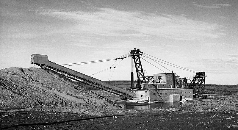
A mining dredge in action in Nome, Alaska.  This is the largest placer mining dredge in the world.

Here is an opportunity to show your product or service to one of the fastest growing blogs on the Net.  For further information contact us at geotekllc@gmail.com  

Sunday, February 27, 2011

An Auction Site for Used Gold Mining Equipment

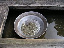
This is an old fashioned gold pan that is still in use today.


What this country has needed for a long time is a good nickel cigar, or a place where you can buy and sell used mining and prospecting equipment in a single website. We may wait quiet while for a nickel cigar, but there is now a website where you can buy and sell used Gold Mining equipment in an auction. The name of the new service is prospecting -- Gold.com that can be reached at: http://www.prospecting-gold.com

They bill themselves as the 1st auction site on the net for gold prospecting gear. They have all equipment, tools, supplies and gear. Be sure you check their gold giveaway page for the latest thing in giveaways. Another page on the site is about gold-mining info and metal detector manuals. The site also contains equipment reviews and free plans for building your own gold-mining and prospecting equipment.

Thursday, February 24, 2011

Prospecting Ancient Tectonic Ridges

The ridge is at the center of a spreading zone where magma being erupted through the ridge causes spreading that is usually seafloor; one exception is Iceland where the ridge is exposed on dry land.  A ridge is also the home to “black smokers” that are the surface manifestation of leaching minerals from the oceanic crust.  It is fine metal sulfides that cause the smoke like effects when the hot water cools enough to cause these minerals to precipitate where they are deposited in chimney like structures around the black smoker.

The Kidd Creek Mine in Timmins, Ontario an example of a volcanic massive sulfide deposit.
NOAA

 When these sulfides are deposited they persist for billions of years creating mines that are termed “Volcanogenic Massive Sulfides” (VMS).  Some of the greatest metal sulfide deposits on earth are of this type.  There are many examples of deposits of this type around the world two of them are found in the Abitibi region of  Canada the Horne mine is Rouyn-Noranda, Quebec and the Kidd Creek mine in Timmins, Ontario.

Wednesday, February 23, 2011

All that’s precious is not Gold

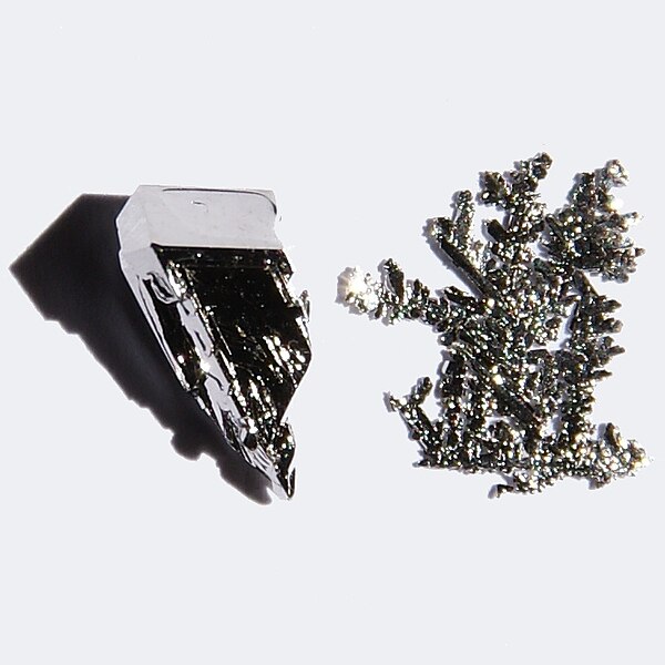
Platinum crystals, platinum is often found with gold.
Photo by Jurii


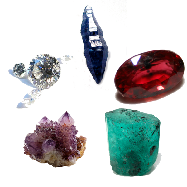
All that's precious is not gold it by any means there are other things we can search the earth for their evening more precious than gold. This includes the platinum group metals (PGM) as well as precious gems. In the course of prospecting for these we often concentrate on gold but there are other things that we might run across in our searches that ultimately can yield more money than gold. We are going to include articles about these other precious things in this Blog in the future.

The Cardinal Gems that by weight can be more precious then gold.
Photo by Rob Lavinsky


Friday, December 31, 2010

How to Build a Simple Magnetometer for finding Gold

The earth is nothing more then a giant magnet as attested by its magnetic poles that attract a magnetic needle to magnetic North and South. The same phenomenon of magnetic attraction can be used to detect magnetic minerals even as small as what are termed micro-mounts, or for that matter large masses of magnetic mineral like magnetite below the surface of the earth. Although gold itself is not magnetic that often occurs in the company of different minerals that are; one example is granular magnetite.

This deceptively simple magnetometer can be used both at home or in the field. Its materials are also simple consisting of a very few parts that are obtainable anywhere. The core of this magnetometer is nothing more complicated than an ordinary soda straw with a small magnet glued on one end. There is a needle shoved through the straw at approximately its balance point with the magnet attached. The needle rests on two parallel sides are far enough apart to allow the straw to present up and down.

The best kind of magnet that you can use as a so-called rare earth magnet that is far more powerful than an ordinary magnet. Small maintenance of this type can be found in auto parts stores, sources say are part of an automobile alternator they can also be found in your local junkyard. The best kind of soda straw to use is one that has a flexible joint near its upper end, so you can bend the straw to get it perfectly balanced.

At home your magnetometer is used to detect magnetic minerals that is accomplished by passing the near the magnetic tip to see if the magnet is attracted. If it is you know immediately whether or not the mineral is magnetic, conversely if the magnet is not attracted to the specimen then it is not magnetic. This is important because many minerals look alike and the magnetometer test is one step in identifying the mineral.

In the field; all you have to do is walk a straight line while watching the straw, if the magnet is attracted to a magnetic mass in the ground the straw will move up or down. This is also important because many different mineral deposits are magnetic and have other minerals that are associated with them including gold. A simple method of measuring the amount of dip is by placing a quadrant next to the straw allowing you to measure the amount of dip the straw undergoes.

A simple magnetometer of the type described can be seen by following this URL:


Wednesday, December 15, 2010

Hard Rock Prospecting


Prospecting in hard rock is much different the prospecting in the bed of a stream all though valuable minerals are often found by tracing a trail of specific minerals up a stream until you reach a point where the minerals vanish. When you have reached this point you start looking at the bedrock to see where it had weathered from. Hard rock prospecting is much more complicated than finding placer deposits; it is also much more observational. In this case gold and the other valuable minerals are encased in rock of one sort or another. This enclosing rock is called by the German name “Gangue” a useless rock enclosing the valuable minerals that you are looking for. While quartz is the most common gangue mineral there are plenty of others like calcium carbonate, barite, fluorite and list goes on.

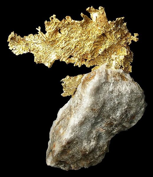
Gold on Quartz     Rob Lavinsky Photo

In many respects hard rock prospecting is a science of whys, why is that rock discolored, why is that water discolored, why is that vegetation stunted are only a few of the many things prospectors look for in the field. A good prospector will examine every outcrop of rock in the area where he is prospecting looking for signs that it might contain a valuable mineral deposit. The basic tools they uses for finding minerals in the hard rock are a geologists pick, and a magnifying glass usually a loupe having 10X. magnification.

The most common indicator of a valuable mineral because it looks exactly like rust, because it is rust, iron oxide that is called a gossen. Just like many other words used in mining and prospecting is derived from German in this case the word gossen means “iron hat.” This is caused by the weathering of iron bearing minerals usually pyrite, but pyrite often contains other metals in what is called a solid solution series. Because they are so obvious finding a gossen nowadays is virtually impossible.

Iron Staining (gossen) on the wall of Kidd Creek Mine Timmins, Ontario   NOAA

The most sought after metal and prospecting is gold, and the old saying goes, “Gold is where you find it.” Although it is usually found in quartz veins and stringers throughout any rock that is been affected by hydrothermal activity gold can also be found in many many other types of rocks. The world's largest gold deposits are found in the Witwatersrand in South Africa. For over a century the source of the gold has been debated, but it has been recently discovered the gold deposits in the Witwatersrand come out of fossil remnants of an ancient mountain range.

When he is in the field the prospector is always looking for rocks that are discolored by the action of hot water, rocks that are deformed, faults in the rock that are often the channel for mineral bearing hot water. When he finally finds an area that looks promising the very first thing he does is to collect several grab samples across the width of the presumed mineral deposit for later analysis in a lab. If the results are promising he will go back and chisel a channel right across the vain in several different places. The samples from each vain are kept separate and are also sent to a lab for analysis.

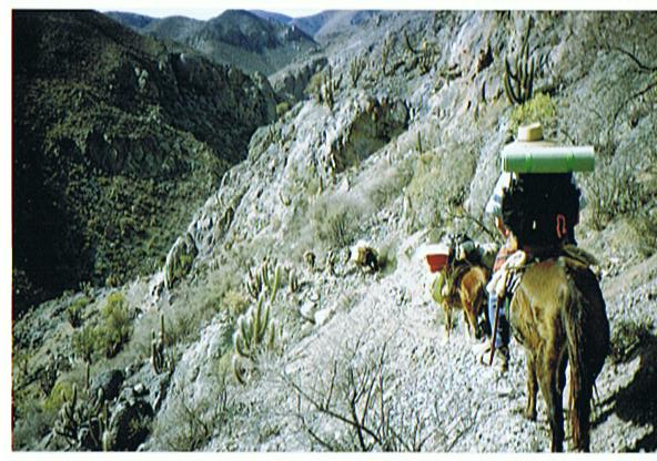
Prospectors in northern Chile

Sometimes it is virtually impossible to find any outcrops of rock in this case the prospector has to dig down through the overlaying soil until he reaches bedrock where he may find some viable mineralization by observing some of the indicators that are visible above the soil.

Although hard rock prospecting can be a one-man job more often it is left up to a team of explorers each of whom has his own specialty that is generally led by a geologist or geophysicist. An exploration team like this is capable of finding deposits of gold and other metals in many places that are beyond the capabilities of the single prospector.

Copper Ore   Hannes Grobe

One of the things the prospector always has to keep in mind is the odds are stacked against them because for every showing of ore only one in about 300 will prove to be viable for constructing a mine. There was a book published in the late 1900s titled, "Gamblers Ruin" a how to book about nine evaluation.although this particular book has been long out of print there are several good books on the subject that are still available with many of them up to date.

Monday, December 13, 2010

How to use Google Earth as a Prospecting Tool

Google Earth is so new it that has not had much of a chance to be used as a prospecting tool, but it is just like flying around in an airplane only much less expensive. other forms of satellite imagery and  aerial photographs have been used for years for a prospecting for valuable mineral deposits. With Google Earth it is possible to see the lay of the land without ever going to the site, so you can plan a prospecting trip before you ever get there. What is especially good about the program is that you can see places where gold and other valuable minerals are apt to be hiding.

The first thing you notice about Google Earth is that all the photos are vertical just like those used in geological mapping. You can also change Google Earth images so they are displayed as oblique photographs; for many people not used to vertical photographs the oblique photographs are more natural,and are easier to understand.

Natural Bridge area in Utah. Note the lineations depicted in this picture as well as the watercourses that are possible indications of a fault.

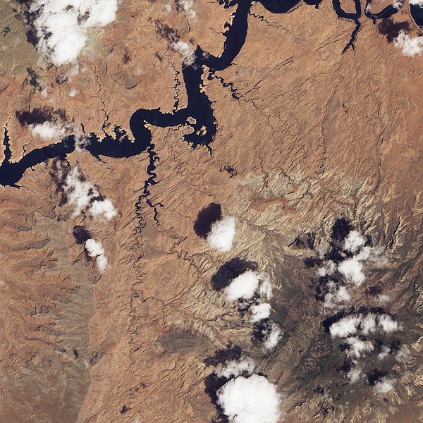
The next things you will notice if you look for are the number of lineations that can be seen in a Google Earth image. These are important because they often outlined a fault in the Earth's surface. Faults are often the home of valuable mineral deposits that have been deposited by hydrothermal activity.

Another place where Google Earth comes in handy is mapping the watercourses of streams and rivers. It should be remembered that streams and rivers often follow the line of least resistance this is usually a fault or contact between differing rock types. We can interpret these as zones of weakness that are apt to contain mineral deposits.

Another place where mineral deposits may be found is in areas with sudden changes in vegetation.  One example is most sand & gravel deposits are under growths of white pines.  In other places changes from deciduous trees might indicate an area is shallow to bedrock.  The presence of certain species of trees like oak that have a long taproot indicate the soil is deep and a long way from bedrock.  In deserts the presence of vegetation is often an indicator of water courses.

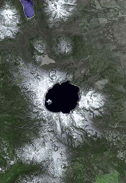
Satellite view of Crater Lake, Oregon USGS

Another feature that is readily seen on these images is the location of already existing mines. There is an old saying among Canadian prospectors that the best place to prospect for a mineral deposit is under the shadow of the head frame of an existing mine.

By looking at stream courses in a given area it is actually possible to pick up many of the places where placer deposits may exist in the inside bends of streams, or in former stream channels that are often visible on a satellite image.

Monteregian Hills, Quebec noted for rare minerals caused by magma intrusions from a traveling hotspot.

One of the neat things about Google Earth is a read out at the bottom of the display the geographic coordinates in degrees, minutes and seconds making it possible to transfer those readings to a GPS unit so you can find your way on the ground to areas you saw on Google Earth, 

Friday, December 3, 2010

Field Analysis while Prospecting for Gold

If you ever wanted instant analysis of a sample or ore while prospecting in a re,ote area the portable X-ray Fluorescence Meter is just what you want.  They are pretty pricey, but can be rented from various sources for around $500 per day.

These are a portable x-ray fluorescence meters in action by Niton analyzing copper wire in the field.


There are a number of companies manufacturing portable x-ray fluorescence meters used for identifying different elements in the field whether prospecting or any of a variety of other ways where specific analyses of any chemical element is required.  With one of these meters you can determine the composition of any mineral right in the field without having to take samples home that are later sent to a lab for analysis.

The meter also has many applications in the environmental field among them are identifying lead based paint and other contaminants in the field.  The device will identify all the heavy metals as well as other contaminants.  The EPA and other government bodies use the technology for protecting the public from dangerous substances because of its fast, nondestructive, fast and is capable of being hand-held. 

It is regularly used in the mining industry for field sampling in mineral exploration work in active mining to effectively trace ore shoots.  With this device it is possible to know what you are dealing with eliminating the need to send samples to an outside lab thereby saving time and costs.  

Another example of a hand-held portable x-ray fluorescence meter manufactured in China.
  

The best thing about these devices is they are all hand held about the size of an electric drill.  One of these units can be carried in a holster like a pistol, and in fact are pistol shaped.  The whole instrument ready to use only weighs around 11 pounds (5.5 kg).  They are capable of identifying up to 25 elements at a time that are displayed on a screen at the back of the device.  Not only does the device tell you what elements are present, but also indicates how abundant they are.