Total Pageviews

Showing posts with label Quebec. Show all posts

Wednesday, August 17, 2011

Gold Occurrences in Quebec


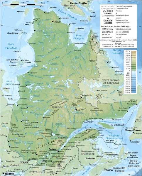
Topographic Map of Quebec   NASA


There are many gold deposits in Quebec many of which are being explored or developed into active gold mines at this moment.  The province is also the eastern terminus of the Abitibi Gold Belt that begins in Wawa Ontario and supposedly ends at Val D’or Quebec.  This is the second largest gold belt on earth only the Witwatersrand of South Africa is larger.  Since it was first discovered in the early 1900s the Abitibi has produced more then 160 million troy ounces of gold, more then there is in Fort Knox.

There are several different parts of the province that contain gold either as native gold or associated with other metals of which copper is one.  This is the case in the copper/gold mines around Chibougmau.  There is a goldmine located about 60 km west of Chibougmau on Rt 113 in the Chapais Mining Camp. Further north these is mining exploration work being undertaken on the Taigus Road that goes from Radisson east to within a little more then 100 km from the Labrador border.  There is also further exploration work being done in the far north of Quebec in the Ungava Bay Territory.  

The Matagami Camp is another hotspot of activity for both gold mining and exploration with several mining and exploration examining the surrounding area for gold and other base metals.  Exploration has reached the level where a surface mine is being opened near the town of Malartic between Val D’or and Rouyn-Noranda.  This site is located in the Abitibi Gold Belt.  A new find of Volcanogenic Massive Sulfides has been reported near Rouyn-Noranda. 

A great deal of exploration and mining activity is found north of the St. Lawrence River especially in Archean aged rocks, but most of the placer activity is found south of the river especially in the rivers and streams that drain the Height of the Land on the Maine Border.  Gold is found in the area centered on Sherbrooke and Thetford Mines as well as along the Chaudiere River.  This is an interesting area because it also displays the same kind of chaotic geology as the rest of the area that is on the seaward side of the Brampton/Baie Verte fault where continental terrane and oceanic terrane collided during the Taconic Orogeny forming the Iapetus Suture Zone.  This entire area in the Eastern Townships warrants further exploration for lode gold.  

Thursday, March 31, 2011

The Abitibi Gold Province of Eastern Canada

During the course of writing the articles about the states in the American Midwest where gold occurrences are we made several references to the Abitibi Gold Belt in Canada located in the provinces of Québec and Ontario. This is what the Abitibi is about.

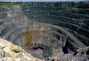
The Dome Mine in Timmins, Ontario one of the original gold mines of the Porcupine Gold Rush

We are taught about the great gold rushes that occurred in the Western United States during the latter part of the 19th century, but we know very little about the biggest Goldrush that ever occurred in North America. Know was that the California gold rush, nor was it the Klondike Gold Rush it was the Porcupine Goldrush that occurred about 600 miles north of New York City in Porcupine, Ontario. 

This Goldrush occurred in the Abitibi Gold belt that has proved to be one of the great gold bearing provinces on earth, and appears to be exceeded in size only by the Witwatersrand of South Africa.  The Abitibi is a continuous band of gneiss, granite and greenstone extending from Wawa, Ontario to Val d’Or, Québec that is the same goes is produced more gold than there is in Fort Knox. Since 1901 the gold mines of the Abitibi region of produced more than 170,000,000 ounces of gold; more than 68,000,000 ounces of them produced in the Township of Timmins, Ontario alone.

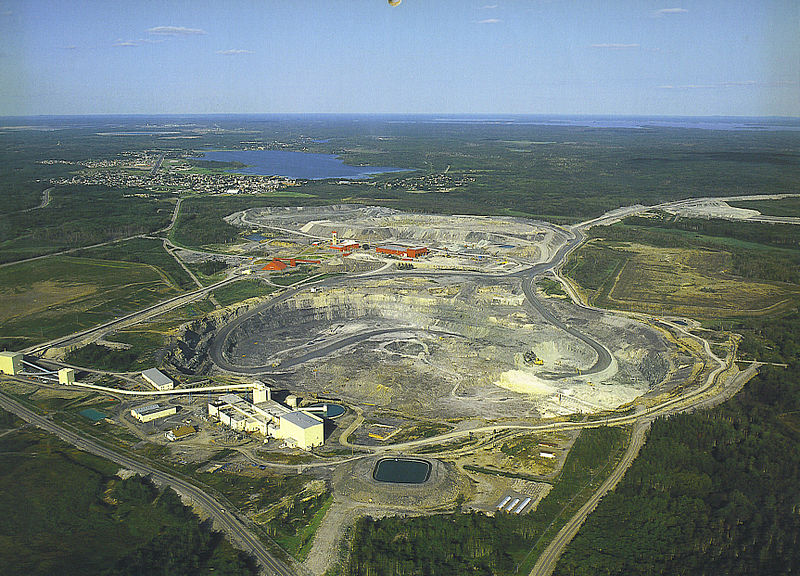
The Kidd Creek Mine in Timmins Ontario a leading producer of copper and zinc.  NOAA

During its history of his loss of more than 100 years they have a time he gold belt has produced over 100 gold mines, and from recent exploration it appears that the Abitibi is going to produce even more gold than it has in the past. Gold is not the only metal that is produced in the Abitibi Gold belt it has also been the scene of some very large base metal mines. It is in the same town of Timmins that the fabulous Kidd Creek Mine is located that kicked off a mining rush in early 1964 that today is producing copper and zinc along with other metals at a depth around 9500 feet making it one of the deepest mines in North America. It also produced the base metal mines around Rouyn-Noranda said gave birth to the Noranda Mining Company that during its day was one of the largest mining companies in the world.

Aside from its production of over 170,000,000 ounces of gold the Abitibi has also produced 35,000,000,000 pounds of zinc, 15,000,000,000 pounds of copper and 400,000,000 ounces of silver. In addition there are several minor metals that are also produced like germanium and indium. Even today they keep finding more mineral deposits in the Abitibi.


.

Wednesday, January 12, 2011

The Ammonoosuc Gold Belt in New Hampshire:

The Ammonoosuc Gold Belt in New Hampshire is only a part of a much larger gold bearing district that extends out of southeastern Vermont and up the Connecticut River to New Hampshire and Québec even further north. In New Hampshire this belt contains the highest potential in the entire state where important discoveries of gold and other metals may be found.

This gold bearing district is closely associated with the Iapetus Suture Zone caused by the closing of the Iapetus Ocean hundreds of millions of years ago. This suture zone is traceable all away from Staten Island New York across the Atlantic Ocean to the mountains of northern Norway. Although this is one of the major suture zones on earth it has been little explored by miners.

Rocks found in this belt are metamorphic in origin for many of them were originally deposited as volcanics that could be endowed with gold. This zone is now the host of the most intense placer gold recovery in the state that in recent years has taken place in the sand and gravel deposits throughout the district.
The Ammonoosuc River at the Littleton Grist Mill during the Winter
Photo by Captain Tucker

The rocks found in the White Mountains and other genetically associated rocks to the South like those within the Patuckaway Mountains are also considered to be favorable for gold prospecting. Throughout the state the potential for gold being found along faults is high especially in those that have been acted upon by hydrothermal waters were quartz has been deposited in veins as so-called bull quartz. Bull quartz is a particular milky variety of crystalline quartz in veins that often has gold deposited on the interfaces of its crystals.

Gold has been found in many of the streams of northern and western New Hampshire included in this partial list:

Town Stream
Benton Tunnel Brook
Lincoln Notch Brook
Lisbon Salmon hole Brook
Wild Ammonoosuc River
Ammonoosuc River below the town of Bath

Northern Coos County

Indian Stream
Perry Stream
Dead Diamond River
Swift diamond River

Because of the potential damage that they can cause all gold panners should try to keep the disturbance of the stream beds of the low level of disturbance.

A great deal of information about gold found in New Hampshire is available from the geological survey of the state that is located in Concord. Another source of information is often to be found in old town histories.