Total Pageviews

Showing posts with label Canada. Show all posts

Thursday, August 16, 2012

East Coast Gold

East Coast Gold


Geological map of North America   USGS

This book is like none other, because it deals with gold found on the East Coast of North America.  The scope of the book takes us all the way from Greenland, through Eastern Canada and the United States all the way to Alabama.  This includes chapters on each of the individual areas whether they are states or provinces.  It also includes chapters explaining the technical aspects of hunting for gold in this area.

It does not include places where to hunt for gold because if I knew the places I’d be there first.  It does explain where to hunt for gold and the geological reasons behind the hunt.  It also explains the geological terrain where gold is most likely to be found.

The book will be published initially as an E-book costing US$29.99

We aren’t ready to take orders, but the book will be ready by Christmas; we hope to have it by Halloween.

If the demand is enough we will publish this book later in hard copy.   If you want to reserve a hard copy go <HERE>

Tuesday, May 15, 2012

The Lost Arch Gold Diggings


A Natural Arch similar to that found in the Turtle's Range of California.
Photo by Library of Congress Prints


We first became familiar with the story of the Lost Arch Gold Diggings by reading an account of the story in the Earth Science Digest a publication that has been long out of print that coupled with tales of my great grandfather’s gold prospecting and mining in eastern Canada in the 1860 fired my imagination for the lure of gold that remains to this day.

The story begins in the northern part of the Turtle Range that lies east and south of a range called the Old Woman’s Mountain on the Colorado River in California.  The Lost Arch Diggings have the distinction of being twice found and twice lost because some strange acts of Providence.

Jim Fish and a prospector that had arrived in California with the first gold rush in 1848 were on their way from Nevada to California in an old-fashioned buckboard drawn by a team of stringy bay horses.  While crossing the Colorado River they had filled their water barrel from the river.  From there they continued to make their slow search for hidden wealth.  They had been looking for gold for months already with little luck.

Two days after crossing the river Fish discovered their barrel was leaking, and when they turned the barrel so the bung-hole was pointing downwards barely two canteens of water flowed out.  Although Fish’s discovery was un-nerving it was a situation that was only to familiar to anyone that was used to traveling through the mountains.  When his partner returned, it is said his name was Crocker, he told him the bad news, so it was decided they would spend a day looking for water in the vegetation covered gulches they saw in the mountains.  

After spending a restless night early the next morning they set off on their search.  “Crocker went up one canyon while I took another, the one to the right,” recounted Fish to some friends from San Bernardino, California some months later.  He went on, “The main canyon deployed into a gulch on the right and I decided to follow this through the hot sun and down among the rocks so far that not a breath of air seemed to pass through the cleft. On and on I went, over stones larger than a house, around smooth and slippery boulders where water had certainly been at one time, but where then not a trace showed.

“My feet were lagging; my shins were barked and aching, for in the rush I had neglected to be careful. Turning a sudden corner in the gulch, I came upon a natural bridge that spanned the canyon. It was so odd, so regular in the outline of an arch that I could only stand and admire it. Beneath its shade, the most cooling place in the hell-hole, I found a large sandy area and there sank down to rest.

“While idly scratching the sand, its peculiarity attracted my closer attention. I got down on my knees and started to blow the dust away, and before me I had a great pocket of precious metal, gold that averaged the size of wheat grains. I filled several pockets with the heavy grains and, with all thought of thirst forgotten, hurried excitedly down the canyon to impart the news of the find to Crocker.”

After arriving at the buckboard Fish had to wait for several hours before Crocker showed up again.  Crocker finally showed up hours later despairing that he hadn’t found any water where he went.  At that moment gold was the last thing on their minds because all their thoughts were their quest for water, and the nearest water was in the Colorado River two days distant.

After a harrowing trip to the river they finally reached it only to have Crocker die a few days later and left Fish in a state of shock that took three months of recovery before Fish could set out for the Turtle’s again.  After expending all his money on a fruitless search Fish gave up the quest.

In 1900 a German prospector whose name was probably Peter Kohler came back from the Turtle’s came back from them with a tale of rediscovering the Lost Arch, but because he had been a naturalist in the Old Country he didn’t have a thought about any gold there, he was completely lost in the beauty and strangeness of the setting.  He had never hears Fish’s story of the gold so he missed the chance of a lifetime.

Later a prospector named John Packer searched in vain for ten years without finding a trace of the Lost Arch Diggings.  The desert is a strange place that has the capability of changing its face in the blink of an eye; perhaps a flash flood destroyed the arch and its usefulness as a landmark.

Tuesday, March 20, 2012

Gold Occurrences in Ecuador


Coat of Arms of Wcuador

Ecuador is nestled between Colombia and Peru, but has seen nowhere the amount of exploration the other two countries have, a statement that is especially true of Peru.  According to some of the giants of the gold mining industry like Barrick and Newmont Ecuador is the prime place for exploration.  This is where the gold discoveries are going to be made, not in Peru where they are already mining gold.  Even though Colombia and Peru contain some really big deposits of gold Ecuador just hasn’t seen the level of exploration that has gone on in these other countries.

A great deal of gold has been found over the ages in south-eastern Ecuador including the gold used by the Incas from Pizzaro in the early 1500s.  This was enough gold to fill a room, but the Spaniards still executed the last of the Inca emperors.  The gold found here is epithermal in nature with drilling results by Aurelian Resources indicating a multi-million ounce deposit at their Fruta Del Norte project.

Today there are several exploration companies that are uncovering the enormous potential of this little explored region of South America.  Many of these exploration companies are working within a few kilometers from where Aurelian has its Fruta Del Norte property.  Many of these companies are exploring deposits that could potentially yield many ounces of gold.

Chimborazo one of the many volcanoes found in Ecuador that have epithermal gold deposits associated with them.
Photo by David Torres Costales


The majority of these companies are from Canada that are talking among themselves about arranging joint ventures.  The country of Ecuador is clearly open for business with all indications they have a government that is open for business and are prepared to act in a responsible manner.

Most of the Canadian and other companies are concentrating on the potential of developing lode gold deposits although there is plenty of room for placer deposits along the rivers and streams of Ecuador.  A great many of the deposits in this district are along tributaries of the Amazon River.

The potential for finding gemstones in this part of the world is also high it is just across the border in Colombia where some of the largest emerald mines in the world are located.  Years ago your author while exploring another of the tributaries of the Amazon discovered several sandbars that were littered with gem grade topaz that also contained placer gold.

Thursday, November 17, 2011

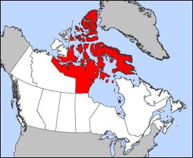
Gold Occurrences in Nunavut

Nunavut is shown in red.


Eastern Nunavut is dominated by the mountains of the Arctic Cordillera a range of volcanic mountains that extends southwards from Ellsmere Island to the Torngat Mountains of northern Labrador and Quebec.  At 8,583 feet (2.616 meters) Barbeau Peak is considered to be the highest point on the east coast of North America.  Many of these mountains are of volcanic origin, and some of them still display cones.  It is the inhospitable nature of the Canadian Archipelago combined with the volcanic nature of these mountains that we must assume there is plenty of gold that hasn’t been discovered yet.

In essence the Arctic Cordillera are reworked rocks of the Canadian Shield and in many respects are similar to the Appalachians although the orogeny that formed them is much younger.  The area is fairly heavily intruded with volcanics that are associated with the orogeny.  To the west of these mountains Nunavut is composed of older rocks belonging to the Canadian Shield.  There are a series of greenstone belts that are found throughout the Canadian Shield including those found in Nunavut.  It is in these rocks that much of the gold in Canada has been found.


The Meadowbank Gold Mine under construction.
Photo by Agrico-Eagle Mining


Nunavut’s first gold mine opened in 2010 operated by Agnico-Eagle it is the first gold mine in the Territory and the first gold mine to become operational here.  The mine is called the Meadowlake Mine that opened in June 2010.  Exploration for other mines is proceeding.  There have been plenty of problems this mine has faced ranging from difficulty in off-loading freighters, leaky dikes, getting permits and delays in completing an airport capable of handling jets.  With these problems it has been estimated that production at this mine is apt to be more then CN$350 per ounce.

At one time in 1999 there were two operational mines in Nunavut both of these mines produced lead-zinc.  One of these mines had the title of being the most northerly mine in the world.  This was the Polaris Mine on Little Churchill Island.  The Nanisivik near the village of the same name produced silver along with the production of lead-zinc.  Both mines are now closed.

There is an active exploration industry and several other mines are in the process of being opened.  Prospecting in Nunavut is expensive but there are grants made available from the territory of $8,000 if you are a serious prospector. The territory also conducts classes for the local population in a program that travels from community to another conducting night and field classes for the people living there. These classes have been conducted for several years, and it was a local prospector who took the classes that found a deposit of gemstones in 2001 that he sold to a mining company.
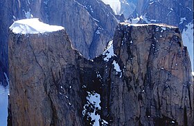
Mt Aasgard in Nunavut is one example of the terrain you will encounter.  It is located on Baffin Island


Unlike other parts of Canada, Nunavut has not been well mapped so there is plenty of opportunity for prospectors to find valuable mineral deposits. One of the things that you have to be careful of is that it takes about 100 prospects before you can develop a single mine. 

Tuesday, November 15, 2011

Gold Occurrences in the Northwest Territory of Canada

The NWT of Canada


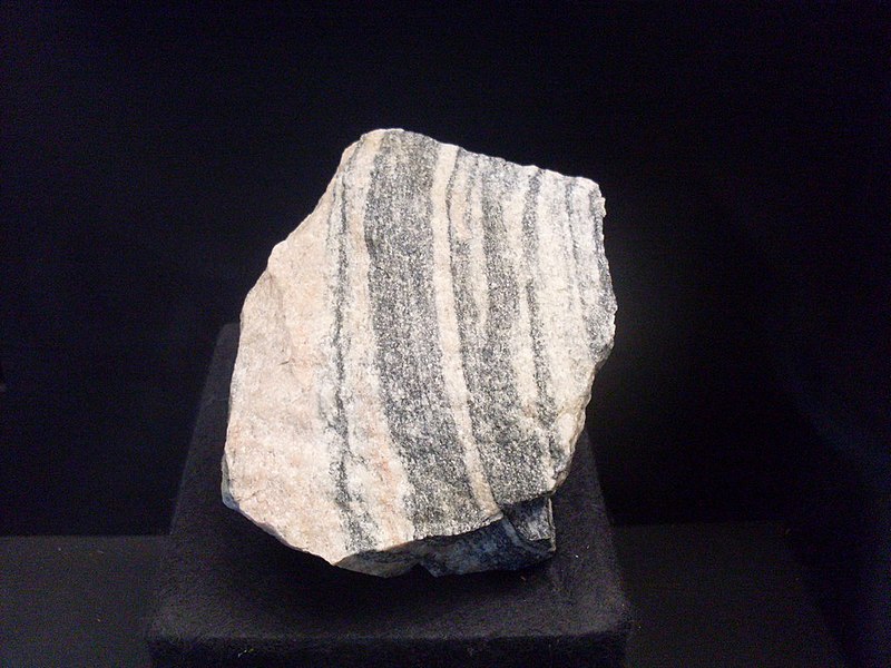
Some of the oldest rocks on Earth are the Acasta Gneiss found in the Northwest Territory of Canada.  The rock itself is metamorphosed sedimentary rock that is far older then its radiometric date of 3.8 billion years.  A zircon found in this rock has been dated as 4.03 billion years old.  These rocks of the Acasta formation are by far the oldest rocks discovered in North America, and were originally laid down in the Hadean era.

A fragment of the Acasta Gneiss on display in the Natural History Museum in Vienna.
Photo by Pedro Alexandrade


Unlike the Yukon that lies to the west of the NWT that has no exposed rock of the Canadian Shield most of the territory is composed of rocks of the shield.  These rocks display plenty of greenstone belts notably the Yellowknife Greenstone Belt near Great Slave Lake.

Gold was discovered in the territory in 1898, but active mining did not commence until the mid 1930s in the area around Yellowknife. The opportunities for additional exploration and prospecting in the territory abound. There are other valuable mineral deposits that are being worked in the territory including uranium and the recent discoveries of diamonds have resulted from the opening of diamond mines.

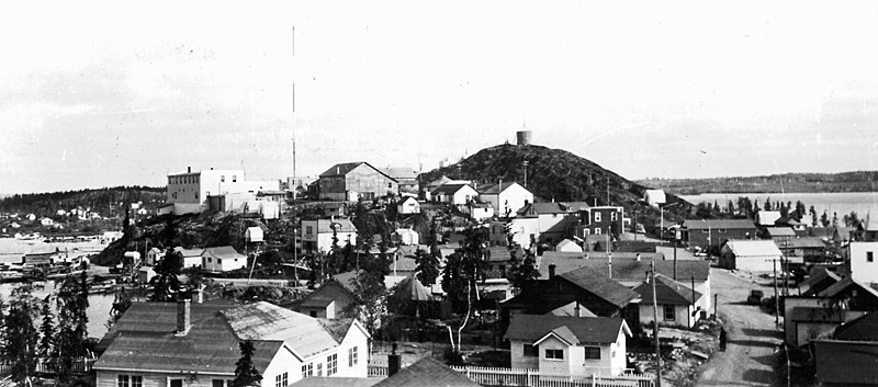
Yellowknife, NWT in the mid 20th century.
Photo by YK Times


A vast amount of information is available through the Northwest Territory’s Geoscience Office in Yellowknife. Another source of information is the Prospectors and Developers Association of Canada (PDAC) in Toronto, Ontario. The Northern Miner in Toronto is a weekly newspaper covering the mining industry worldwide including the Northwest Territory.

Prospecting for Gold the Northwest Territories of Canada along with many other valuable minerals including copper, diamonds and uranium is a viable occupation. Parts of the territory along the Arctic coast and on the islands in the Arctic Ocean contain gas and oil. A few years ago a geologist inadvertently published the locations of test wells on Ellsmere Island and received a proper wigging for his efforts. The territory depends on mining for most of its economy. Today however the emphasis is on diamonds rather then gold.

A significant gold discovery has recently been announced at the REN gold site. The gold was discovered in a seven kilometer long iron formation. Gold is often associated with iron especially with the ore granular magnetite. Some of the grab samples of ore collected have as much as 198 g/t of gold. In follow-up drilling more gold was found in the host rocks adjacent to the gold rich body of iron ore.  The area around Yellowknife is dominated by the Yellowknife Greenstone Belt that has been the scene of several past and present gold mines.

Over the years there have been a number of gold mines found in the area around Yellowknife the territory’s capitol. This city was originally settled as a gold camp and became the capitol later. The diamond mining industry is now centered Yellowknife although the actual mines are located to the Northeast of the city around the Lac de Gras area.


Thursday, October 13, 2011

Why there is little or no Placer Gold in the Northern US or Canada

The answer is simple; the action of the glacier destroyed the placer gold deposits. It is hard to realize that the last period of continental glaciation lasted until about 12,500 years ago when the glaciers started to recede. The northern U.S. and Canada were covered with ice sheets that were up to two miles thick. It was the grinding action of this glacier that destroyed most placer deposits of gold.

Two exceptions to this continental glaciation can be found in Alaska and Northeastern Siberia. This whole area was largely ice free due to its arid climate during the period of continental glaciation. In Alaska this left the Tintina Gold Belt largely uncovered giving rise to two of the greatest gold rushes of modern times; the Klondike and the Fairbanks rushes. In Siberia extensive placer deposits of gold were found in the Kolyma River Basin that gave rise to the slave labor camps that were known as the Gulag. This area was above water during the glaciations and was known as Berengaria a continental landmass of continental proportions. Berengaria provided a land bridge between Asia and North America allowing the migration of animals and mankind from one to another.

Due to the grinding action in a large glacier it is doubtful that little or no gold in the northern U.S. had its origin in Canada. To be reduced to fine powder gold it wouldn’t have to travel too far in a glacier with a top figure of around 300 kilometers.

The thin placer deposits found in New England are more likely have been derived from lode deposits buried under the covering of glacial till that for the most part is around 4 meters deep and can range to well over 100 meters. We have personally observed lode gold deposits in place making it virtually possible that if you are finding placer deposits larger then gold dust that it has its origin in buried lode deposits.

In New England the glacier traveled roughly northwest to southeast. On one occasion we observed a gold nugget from a stream in western Connecticut that weighed about a pound. This nugget was barely rounded and was at least one-half quartz, a clear indication it hadn’t traveled too far from its source. For that reason we would like to have reports of any placer gold found in New England larger then flour gold. You can reach us at geotekllc@gmail.com.

Tuesday, August 30, 2011

The National Instrument 43-101 (the NI 43-101 or the NI


This is a mineral resource scheme that is used in Canada for the public disclosure of information about mineral properties in Canada or by extension all over the world if securities in the companies promoting such properties are sold to the Canadian Public.  In practice the NI 43-101 is a strict guideline about how companies whose stock is traded in Canada can disclose both scientific and technical information about mineral projects on bourses under the supervision of the Canadian Securities Administrators.  The list includes the Toronto Stock Exchange (TSX) or the TSX Venture Exchange (TSX-V).  Many of these companies are listed on other stock exchanges outside Canada, such as the Johannesburg Stock Exchange, Australian Securities, the London Stock Exchange and all the exchanges headquartered in New York City.

There are many different types of reports that are covered including press releases, reports, the reporting of resources and reserves, presentations, oral comments and websites.  Included in the classes of minerals covered are metalliferous deposits, precious metals, coal, bulk minerals, dimension stone, precious stones and mineral sands (placer deposits).  For TSX listing purposes the NI 43-101 Technical Report would have to be accompanied by a report that is prepared in accordance with NI 43-101 specifications.

The NI 43-101 grew out of one of the biggest mining scams in history, the Bre-X (Busang) scandal to protect investors from mineral project disclosures that weren’t substantiated.  The Bre-X scandal occurred when it was claimed there were over 200,000,000 ounces of gold in the deposit or 8% of the total world’s supply.  It was all smoke and mirrors and a huge fraud.  Its chief geologist committed suicide by jumping from a helicopter over the mine-site.  The whole thing was a massive fraud with no gold.  The core samples had been salted with gold, and after analysis in an independent lab many of them proved to be scrapings from jewelry.  The investors lost their shirts!

Bluntly, the purpose of the NI 43-101 is to protect investors from misleading, erroneous or fraudulent information or claims relating to mineral properties is not published or promoted to investors on stock exchanges that are overseen by the Canadian Securities Authority.  This includes stock issued by foreign corporations selling securities in Canada.  

The NI 43-101 stipulates and codifies the form and content of a compliant report (i.e.; a report that complies with the Reporting Standard).
Prescribed disclosure within the National Instrument relates to;
§                    All disclosure of scientific or technical data, including disclosure of a mineral resource or mineral reserve, concerning a mineral project on a property material to the issuer must be based upon information prepared by or under the supervision of a qualified person

§                    What the National Instrument is to be used for, such as which types of mineral properties must be covered by a compliant report
§                    Prescribes the terminology to be used to describe various features, both geologically and financially, within the report
§                    Stipulates the type of information to be discussed and the technical data which must be portrayed, for various levels of reporting
§                    Prescribes a list of approved Competent Persons, and the definition of Groups and Associations which may qualify to certify such a person as "Qualified"
§                    Prescribes that a Qualified Person vouches for the accuracy and completeness of the contained information and the manner in which it is presented
§                    Provides guidance on reporting Historical mineral resource estimates
Proscribed disclosure within the National Instrument precludes a company from reporting;
§                    quantity, grade, or metal or mineral content of a deposit that has not been categorized as an inferred mineral resource, an indicated mineral resource, a measured mineral resource, a probable mineral reserve or a proven mineral reserve
§                    results of an economic analysis that includes inferred mineral resources
§                                allows for the potential grade, quantity and metal or mineral content of an exploration property, provided that a qualifying statement is made as to this being conceptual in nature
§                    the term preliminary feasibility study, pre-feasibility study or feasibility study when referring to a study unless the study satisfies the criteria set out in the National Instrument

Tuesday, August 16, 2011

Gold Occurrences in New Brunswick


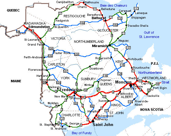
Road Map of New Brunswick


Because New Brunswick shares an extremely complex geological past with the New England States further south combined with government policy to develop their mineral resources the province has many mines in both the Bathurst camp in northeastern New Brunswick and at the Mt. Pleasant Camp producing a wide variety of metals ranging from the base metals of copper, lead and zinc to the precious metals of gold and silver finishing with rare metals such as indium. At Mt. Pleasant with sizeable amounts of indium occur with deposits of tin, tungsten and molybdenum. The province also exports sizeable amounts of cadmium, bismuth and antimony to a worldwide market.  In the southwest portion of the province there is extensive exploration for gold ongoing along the Clarence Stream.

By virtue of its diverse geological history New Brunswick has several different ways in which gold can occur.  In northern New Brunswick gold is found in the form of epigenetic formations in quartz veins following major faults and shear zones.  It is also found in gossens caused by the oxidation of volcanogenic massive sulfide (VMS) deposits of metals including pyrite and other iron sulfides. 

One of the largest faults found in North America passes through Newfoundland, Nova Scotia and Quebec just Missing New Brunswick by passing just to the north of the province.  This fault continues south through New England finally vanishing into the Atlantic Ocean south of Staten Island, New York.  Through its length it has several different names starting in New York it is called Cameron’s Line through Connecticut.  At the Connecticut/Massachusetts Border it is renamed the Whitcomb Summit Fault through Vermont where it passes along the west shore of Lake Memphramagog where it enters Quebec where it is renamed the Brampton/Baie Verte Fault.  When the continents divided during the Jurassic its northern end passed through the British Isles, and finally it went into the western edge of Norway where it finally vanishes.  This fault in reality is where North America collided with an island arc that was far out in the Iapetus Ocean that preceded the Atlantic Ocean.  In Greek Iapetus was the father of Atlantis for whom the Atlantic Ocean is named..

Like all suture zones its companion fault is interpreted to be a subduction zone with many metallogenic features that are remnants of the ancient ocean floor.  Most of the mineral deposits are found on the oceanic side of the fault where there are many VMS deposits and altered oceanic crust containing gold and other metals.  The altered oceanic crust is greenstone that is suspected to be the source rock for gold deposits.  The Abitibi Gold Belt of Quebec and Ontario has a similar history, but is much older.

There are two major gold producing areas in New Brunswick when this in the northern part of the province and is related to the Bathurst mining district. The other is along the bay in Fundy in the southern part of the province that is called the Annidale Belt. New Brunswick is located at the northern end of the Appalachian Orogen and shares its convoluted geology with the rest of the Appalachian Oregen.  The convoluted geology found in northern New Brunswick can be traced all the way to Staten Island NY.

Another place where placer gold has been found is in the Carboniferous rocks found in central New Brunswick that laps over into the province from Nova Scotia.  One of the places where you might find gold is in the later conglomerates that are products of erosion that washed down from older mountains.

Thursday, August 4, 2011

Gold Occurrences in Newfoundland

Gold from the Nugget Pond Mine in Betts Cove on the Baie Verte Peninsula of Newfoundland.
Photo by Rob Lavinsky


Gold was originally discovered in Newfoundland in the 1870s when there was a flurry of gold mining and prospecting in the Canadian Maritime provinces and Newfoundland.  This activity died down after a few mines were opened and closed again.  My great grandfather was one of those caught up in this early gold rush, but at least he mined enough gold for my great grandmother’s wedding ring.  It was this same gold rush that led to his leaving Canada for the United States as it was discovered he was poaching gold from Crown Lands; he decamped from Canada rather suddenly.

Most of the gold occurrences in Newfoundland are found in the central part of the island, and at latest count there were over 200 mines or prospects.  This is significant because the Baie Verte fault that marks a suture zone where gold is deposited.  The Baie Verte fault cuts across the island from north to south as the dividing line between continental rocks to the west and oceanic rocks to the east already has active gold mines along the strike of the fault.  This fault has been interpreted as a subduction zone that is dipping toward the west. The fault is one of the major faults that were in the super-continent of Pangaea. It extends from Staten Island, New York northwards with several name changes to Newfoundland.  It is also found in Europe from Ireland across Scotland finally cropping out in western Norway.

Gold is only one of the metals associated with this fault where others include copper and other heavy metals.  There have been several important mines found in the area controlled by the fault including the asbestos mines around Thetford Mines, Quebec and numerous gold occurrences.  

Mings Bight was where the first gold was discovered in the 1870s that were followed ca. 1903 by some short-lived mines.  By 1935 there were only 26 recorded instances of gold being found in Newfoundland.  It wasn’t until 1976 when significant gold mineralization was found near Cape Ray on the south coast.  In 1984 another deposit was found at Hope Brook.

A surge in prospecting followed the Hope Brook discovery that lasted until 1990.  The prospecting was focused on some dismembered ultramafic belts that were analogies of the mother lode deposits of California.   Then the search broadened until it included most of central Newfoundland.  The low price of gold during the 1990s virtually stopped exploration until it started to pick-up in 2002 and remains very active.

The island of Newfoundland has produced more then 64 tonnes of gold with previously discovered, and new deposits being explored promising a rich future for gold prospecting in Newfoundland. Gold exploration waned as the gold price fell in the late 1990s but began to accelerate in 2002-03 in conjunction with the strong rebound in the price. As of late 2004,with the price continuing to rise, exploration is very active.
Previously discovered deposits and prospects are all being re-investigated and several promising new grassroots discoveries have been made.

The Province has produced over 64 tonnes of gold, about half of which has been derived as a by-product of base-metal mining.

Friday, July 29, 2011

Gold Occurrences in Labrador

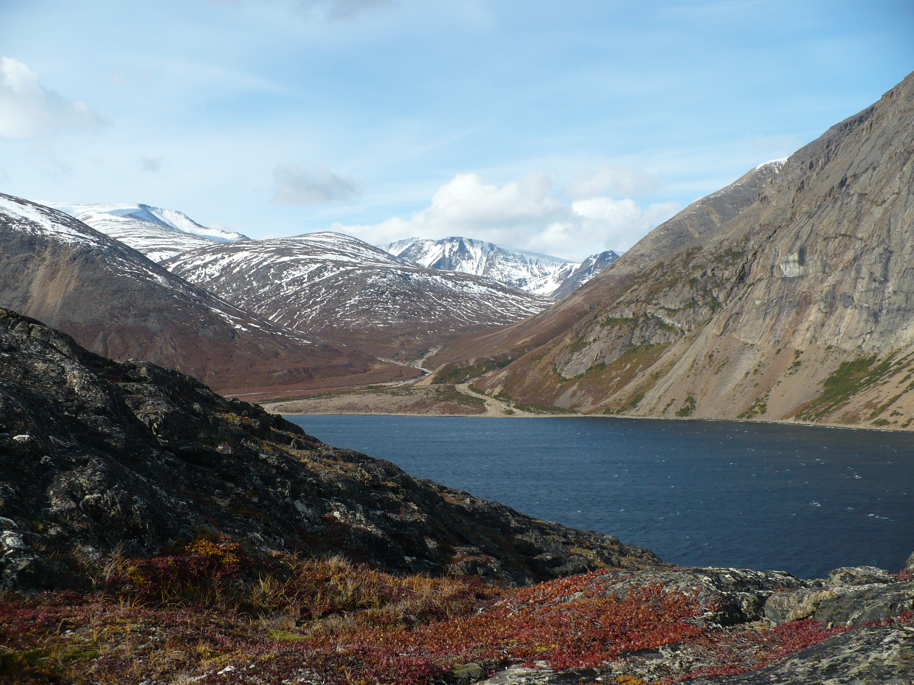
The Torngat Mountains of northern Labrador
Photo by Gierdzep


Politically Newfoundland and Labrador are one province of Canada their geological histories are so different that we have decided to treat them as separate entities.  Throughout most of geological time Labrador has been part of the Canadian Shield with some of its far north disturbed by a fairly recent orogeny that raised the Torngat Mountains.  The Torngats are in Quebec, Labrador and a small pert is in Nunavut.  Geologically they are considered the Artic Cordillera with the highest mountain being Mt. Caubvick at 1,652 m (5,420 ft.)  Geographically Labrador contains some of the wildest land on the East Coast of North America to the point it even lacks a trans-Labrador highway.  It is also little explored even though it is known to contain gold.

Labrador in cells contains very few known gold deposits that are more a function of the lack of exploration rather than the fact that gold isn't there. You will find most of the gold in Labrador Inuit southwest corner where it butts up against Quebec.  This is where they build a railroad From Sept Isles Quebec to Labrador city to transport iron from the mines there and Shefferville Quebec. Gold is often associated with iron mines.

There are many geochemical anomalies of gold phoned him the Archean Nain Province where it is associated with strong iron carbonate alteration of the Florence Lake greenstone belt and in quartz base metal veins at the Aucoin showing.  The superior province also contains several areas that show minor gold mineralization where the northern occurrences are associated with metamorphosed iron deposits in the southern ones with pyrite-pyrrhotote-arsenopyrite veining in mafic and metasedimentary gneisses. Gold is also found in the eastern Makkovik province where it occurs as small being hosted the positives in quartz. These are found in felsic volcanic rocks at Poiniadluk Point.  In the southeastern Churchill Province gold is found that the VBE-2 prospect where it is located in the Tasuyak metasedimentary gneiss that contained up to 5.5 grams per tone located in sulfide-graphite rich layers.

Gold is often found associated with greenstone belts that extend across the Archean all the way from Wawa Ontario to past Chibougamau Quebec.  This is such wild country that it has never been thoroughly explored for gold and it is likely that the Abitibi Greenstone Belt extends eastwards into Labrador.

During the mid-1800s my great-grandfather prospected for gold in Labrador where he found enough to make my great-grandmother's wedding ring. Some prospecting was done as early as 1870.

Friday, April 22, 2011

Meguma Gold of Nova Scotia, Canada

Meguma gold is why I live in the United States instead of Nova Scotia because during the Goldrush that occurred in Nova Scotia in the 1860s my great grandfather as a young man was prospecting for gold in a place where he shouldn’t been prospecting on the Queensland.  The Queensmen took a dim view of these proceedings, and old stories handed down in my family were to the effect that the Queensmen wanted to invite him to a “necktie party” he was to be the guest of honor. Needless to say he left Nova Scotia quite hastily for New York where he worked as a miner at the Tilly Foster iron mine.

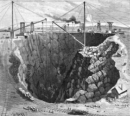
The Tilly Foster Iron Mine in Brewster, NY as it appeared in the 1880s.  This is the mine my great grandfather worked in when he arrived in the US from Canada.


The Meguma terrane is one of the suspect terrenes that is exposed in the southern part of Nova Scotia when it became attached to the North American craton during the Appalachian orogeny where it is joined in Nova Scotia along the Minas Fault Zone that runs east and west across Nova Scotia from Chedabucto Bay to Cobiquid Bay and the Minas Basin. Throughout the area there are a number of granite intrusions that range in age from Devonian to Carboniferous. Although the extent of the Maguma is not clear there are many geologists who believe that a magnetic anomaly that runs along the coast of Cape Cod in Massachusetts may represent a suture zone between the Maguma and Avalon terrenes.

Unlike the Avalon terrane since been definitely associated with land across the Atlantic Ocean the Maguma terrane the Maguma terrane remains a mystery that has not been associated with any land on the other side of the Atlantic Ocean. Even today there are many competing theories as to their origins that are prevalent among geologists. Many of these theories seem to feel that it was separated from Gondwana although there are plenty of other competing theories that it may have been a part of Portugal and Spain.

This is the Ccharbon Mine at Glace Bay NS where my great grandfather worked as a mine rigger before he came to the States.  The product being mined was bituminous coal.  


This area appears to be of interest geologically not only to students of geological history, but because the attendant metamorphism has produced gold deposits that were mined extensively during the latter part of the 19th century, and which remain even today as a source of potentially viable gold deposits.

One geologist that is a friend of mine had for his first assignment in the field as a geologist after graduating from college had to make an assessment on one of these old gold mines. It appeared that the Nova Scotia highway departmental head used the tailings from the mine to pave the roads in the area. His final report to the Mining Company stated that, “The roads in Nova Scotia are paved with gold.”

Gold crystals found on quartz.
Photo by Rob Lavinsky


Gold founded the Maguma terrane according to geologists that have made it a study represent concentrations of a wide variety of gold bearing quartz veins that are found in lower Paleozoic metaturbidites that are found in Southern Nova Scotia where there have been over 30 deposits of this type. Extensive studies of the fluid inclusions found in the quartz indicate that the mineralization occurred at about 370 million years ago that was related to widespread incursion of both mafic and felsic magnetism into the crust at the same time when a sub vertical shear zone was developing. This was during a time that post dated the Acadian Orogeny making them at least partially exotic to the Maguma group. Much of the mineralization in the group is considered to be either late stage magmatic fluids, then infiltrated the Maguma groups that are sedimentary rocks as the sole source of vein components that invalidated earlier sources of hydrothermal fluids.


Thursday, March 31, 2011

The Abitibi Gold Province of Eastern Canada

During the course of writing the articles about the states in the American Midwest where gold occurrences are we made several references to the Abitibi Gold Belt in Canada located in the provinces of Québec and Ontario. This is what the Abitibi is about.

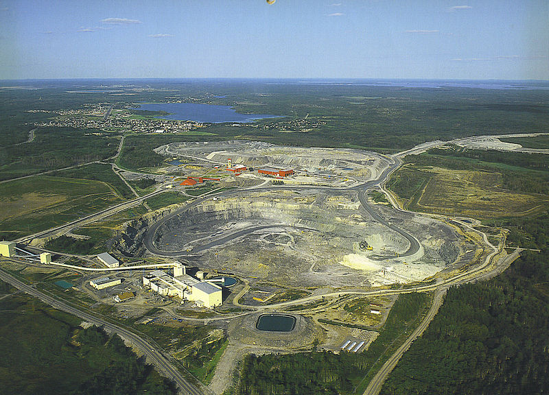
The Dome Mine in Timmins, Ontario one of the original gold mines of the Porcupine Gold Rush

We are taught about the great gold rushes that occurred in the Western United States during the latter part of the 19th century, but we know very little about the biggest Goldrush that ever occurred in North America. Know was that the California gold rush, nor was it the Klondike Gold Rush it was the Porcupine Goldrush that occurred about 600 miles north of New York City in Porcupine, Ontario. 

This Goldrush occurred in the Abitibi Gold belt that has proved to be one of the great gold bearing provinces on earth, and appears to be exceeded in size only by the Witwatersrand of South Africa.  The Abitibi is a continuous band of gneiss, granite and greenstone extending from Wawa, Ontario to Val d’Or, Québec that is the same goes is produced more gold than there is in Fort Knox. Since 1901 the gold mines of the Abitibi region of produced more than 170,000,000 ounces of gold; more than 68,000,000 ounces of them produced in the Township of Timmins, Ontario alone.

The Kidd Creek Mine in Timmins Ontario a leading producer of copper and zinc.  NOAA

During its history of his loss of more than 100 years they have a time he gold belt has produced over 100 gold mines, and from recent exploration it appears that the Abitibi is going to produce even more gold than it has in the past. Gold is not the only metal that is produced in the Abitibi Gold belt it has also been the scene of some very large base metal mines. It is in the same town of Timmins that the fabulous Kidd Creek Mine is located that kicked off a mining rush in early 1964 that today is producing copper and zinc along with other metals at a depth around 9500 feet making it one of the deepest mines in North America. It also produced the base metal mines around Rouyn-Noranda said gave birth to the Noranda Mining Company that during its day was one of the largest mining companies in the world.

Aside from its production of over 170,000,000 ounces of gold the Abitibi has also produced 35,000,000,000 pounds of zinc, 15,000,000,000 pounds of copper and 400,000,000 ounces of silver. In addition there are several minor metals that are also produced like germanium and indium. Even today they keep finding more mineral deposits in the Abitibi.


.

Thursday, March 24, 2011

Gold Occurrences in Wisconsin

There is gold to be found in Wisconsin in the forms of placer deposits in just about any county in the state that were brought here by the many glaciers that have come down from the gold bearing regions of Canada. It should be remembered by prospectors that Wisconsin is divided geologically into two different parts that are nearly equal in size. In the southern part of Wisconsin the basement rocks are buried under a deep deposit of sedimentary rocks that in some places can be miles deep. The northern part of the state is a continuation of the Canadian Shield.

Bedrock map of the Lake Superior region.

Gold found in the northern part of Wisconsin comes from both small lode deposits as well as widespread placer deposits. The placer gold is found in just about any stream or river in the state as well as the beaches along the southern shores of Lake Superior. The deposits lode gold all discovered in several places up to this point none of them found were economically viable. There are several mines in the northern part of the state that are producing both iron and other base metals. Geologically there is no reason why gold should not be associated with these deposits. Just across the border in Michigan there is working gold mining that is produced gold for many years. Of interest are the copper mines that are found in the northern part of the state where the operators of these mines were well aware of the presence of gold, but for economic reasons they just didn't raise the issue.

Throughout the whole state of Wisconsin there are glacial deposits of placer gold brought down from Canada that by being reworked by running water for placer deposits. These deposits are found in the rivers and streams wherever there is a sudden change of velocity in the running water, or on beaches of the many lakes in the state where the gold is concentrated by wave action. Gold of this nature is usually found in fine grains and what is termed flour gold that forces the prospector to become very skillful in the use of the gold pan recover this gold.

Glacial Deposits
Photo by Richard Webb

The gold isn't the only thing the glaciers brought down from Canada; they also brought down several gemstones including diamond, ruby, sapphire and zircon. Weight for weight the stones are actually worth more than gold with the exception of zircon. Deposits of these gemstones are often found in placer gold deposits because there are also concentrated by the action of flowing water. Like gold the glaciers scattered these gemstones across the whole state.

A glacier.
Photo by Kristan Hutchison

Anyone in Wisconsin is allowed to do what is termed recreational gold panning without having to have a license as long as the stream banks and bottoms are not harmed or large amounts of silt and other waste products is not released into the waters of the State. Any gold you find belongs to the person that holds the mineral rights on the property where you found it. You must get permission from the property owner before you do any panning by reaching some sort of agreement with the holder of any mineral rights before you start gold recovery. 

Gold Occurrences in Michigan

Michigan is divided into two parts that have entirely different geology; Lower Michigan is covered by a thick layer of sedimentary rocks were the only gold and is to be found is placer gold. Just about any river or stream in the lower part of Michigan can carry placer gold as well as the beaches of the Great Lakes and other lakes found throughout the state.

A gold pan containing gravel.

Photo by Nate Cull

Upper Michigan is quite different from the other part of the state geologically, and is more in tune with the geology from further north in Canada as a part of the superior province of the Canadian Shield. Most of the placer gold that is found in Michigan had its origin in the Abitibi region of Canada that reaches from Wawa, Ontario to Val D’or, Québec. This is a green stone built that extends for more than 500 km across Canada does little are just gold producing areas on earth having produced since its discovery in 1909 more than 160,000,000 ounces of gold.

Although there is no lode gold in the lower part of the state that isn't true of Upper Michigan that is had several producing lode gold mines. Gold was also been produced as a byproduct from the vast copper mines in the Keweenaw Peninsula. The same mines also produced a considerable amount of native silver that many times was combined with native copper in a product that was known to be early miners as a “bicolor.”

Although gold panning can be done in just about any part of the state one of the better places to find gold is on the shores of Lake Superior where you can find gold in the beach sands. Most of the gold is found in the black sands of your sometimes exposed as stripes along the shore. Because of the way gold was brought into Michigan by the action of glaciers the probability of finding Gold along any of the Great Lakes shores should be considered.

There were a number of hard rock prospects and even some paying gold mines that were found in Marquette County in Lower Michigan. The most famous of these mines was the so-called "Ropes Gold Mine" that operated from 1881 until 1980 that only closed by an underground cave-in causeing so much damage that the mine could no longer be worked at a profit.

A gold prospector at work. 

Many of the prospects of both placer and lode gold deposits were scams. In many cases the property was salted with gold to make it look like a good investment to get money from suckers. There were other mines that operated that were bona-fide gold mines. You might not get rich mining gold in Michigan, but there is always a chance that you will.