
How to use GPS to Stake the Corners of a Claim:
I own a Garmin 90 handheld GPS unit that is designed for use in aircraft that although it doesn’t have all the “bells and whistles” as newer models used for navigating on the ground even so it is quite capable of accurately laying out property lines, and corner locations that is exactly what is called for to layout and stake a claim.
A degree of both latitude and longitude at the equator are 60 nautical mines or 69.046767 statue miles. One minute is one nautical mile or 6080.20 feet, further, a second is 1/60 of a minute or 1,013.37 feet. The GPS unit is set up so it reads in degrees, minutes and seconds. The readout on the Garmin 90 will give you the following information heading in degrees. My unit also gives you the speed at which you are traveling over the ground that probably is not important for any work done on the ground to stake a claim.
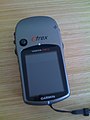 |
| A Garmin GPS Unit |
Any GPS unit will give you your position on the face of the earth in degrees, minutes and seconds a GPS unit is accurate within about twenty feet that is accurate enough for government work especially the Bureau of Land Management (BLM). It also gives the distance from a waypoint like where you started from. Set that position onto your GPS unit as waypoint #1.
When you have established your first position a.k.a. Waypoint #1 laying out a rectangular claim plot is like shooting fish in a barrel. For example if we are heading north to stake the next corner just follow a line showing you are heading straight north on the built in compass. This can be done by pacing (not very accurate, by reading the distance off the unit in parts of a nautical mile (a lot more accurate) or with a tape measure (the most accurate).
 |
| A Garmin GPS Unit in action. |
The GPS unit will indicate the new position where the next corner of the claim is located; enter that into the GPS unit as Waypoint #2. Now either turn east or west to establish the next leg of your boundary line. Measure off the distance to the next corner of the claim, and enter its position into the GPS unit. For the third leg as an example turn another 90 degrees so you are facing due south and measure off the distance to the third corner. Enter its position into the GPS unit then set the GPS unit back onto the first position and then you have successfully staked a claim. You can stake adjacent claims by repeating the steps for the first claim except you only have to establish two corners; the other two corners are already established.
GPS units are also handy for any other use you can dream up like finding your way to the nearest watering hole, or your base camp, or where you found interesting mineralization. The best way to keep this information is in some form of notebook the best is a surveyor’s field book having waterproof paper, and makes the notes with a black ball point pen.
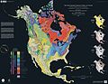 |
| Bedrock map of North America |
Although my GPS unit is intended for aviation it has been used extensively in my environmental consulting for establishing property lines, and the location of test borings, The US DOD only guarantees accuracy within about 20 feet in practice I have found that the accuracy is often far better that is measured in a few inches.
THIS IS IMPORTANT: Before you use your GPS unit for laying out any claims be sure that you carefully read and understand any instructions the manufacturer included with the GPS unit in the first place.
No comments:
Post a Comment